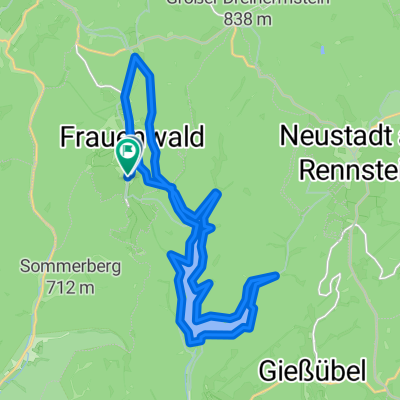
Schönbrunn - Schneekopf
- 60.2 km
- 1,377 m
- 1,118 m
- Frauenwald, Thuringia, Germany
A cycling route starting in Frauenwald, Thuringia, Germany.
Overview
The tour starts in Schönbrunn and leads to the Schneekopf near Suhl.
created this 17 years ago
Route quality
Track
42.1 km
(70 %)
Path
7.8 km
(13 %)
Paved
12 km
(20 %)
Unpaved
45.7 km
(76 %)
Gravel
30.7 km
(51 %)
Asphalt
11.4 km
(19 %)
Continue with Bikemap
You would like to ride Schönbrunn - Schneekopf or customize it for your own trip? Here is what you can do with this Bikemap route:
Free trial for 3 days, or one-time payment. More about Bikemap Premium.
Discover more Premium features.
Get Bikemap PremiumFrom our community
Open it in the app