


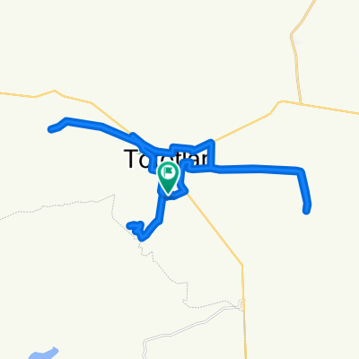
Cerrito de la Cruz-Caja del agua-Coinan
A cycling route starting in Tototlán, Jalisco, Mexico.
Overview
About this route
1
- 2:48 h
- Duration
- 40.9 km
- Distance
- 216 m
- Ascent
- 217 m
- Descent
- 14.6 km/h
- Avg. speed
- ---
- Max. altitude
Juan Pablo Cerda
created this 5 years ago
Route quality
Waytypes & surfaces along the route
Waytypes
Quiet road
34 km
83 %
Access road
4.5 km
11 %
Undefined
2.5 km
6 %
Surfaces
Paved
2.5 km
(6 %)
Asphalt
2.5 km
6 %
Undefined
38.5 km
94 %
Continue with Bikemap
Use, edit, or download this cycling route
You would like to ride Cerrito de la Cruz-Caja del agua-Coinan or customize it for your own trip? Here is what you can do with this Bikemap route:
Free features
- Save this route as favorite or in collections
- Copy & plan your own version of this route
- Sync your route with Garmin or Wahoo
Premium features
Free trial for 3 days, or one-time payment. More about Bikemap Premium.
- Navigate this route on iOS & Android
- Export a GPX / KML file of this route
- Create your custom printout (try it for free)
- Download this route for offline navigation
Discover more Premium features.
Get Bikemap PremiumFrom our community
Other popular routes starting in Tototlán


 Ruta desde Carretera Santo Sabas-Tierra Colorada, Tototlán1
- 12.8 km
- 122 m
- 122 m
- Tototlán, Jalisco, Mexico


Open it in the app