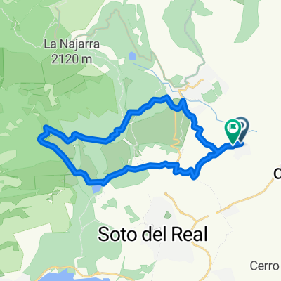
Restful route in Soto del Real
- 35.7 km
- 367 m
- 368 m
- Miraflores de la Sierra, Madrid, Spain
A cycling route starting in Miraflores de la Sierra, Madrid, Spain.
Overview
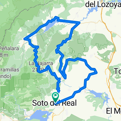
We start from Soto towards Miraflores, there we climb Morcuera and descend the other side to reach Rascafría and continue towards Canencia, we climb the pass and descend the other side to return to Miraflores and follow the road to Bustarviego, from there to Navalafuente, Guadalix and arrive back at Soto.
created this 17 years ago
Route quality
Road
30.3 km
(30 %)
Quiet road
2 km
(2 %)
Paved
25.2 km
(25 %)
Unpaved
1 km
(1 %)
Asphalt
15.1 km
(15 %)
Paved (undefined)
10.1 km
(10 %)
Continue with Bikemap
You would like to ride Soto-Morcuera-Canencia-Soto or customize it for your own trip? Here is what you can do with this Bikemap route:
Free trial for 3 days, or one-time payment. More about Bikemap Premium.
Discover more Premium features.
Get Bikemap PremiumFrom our community
Open it in the app