

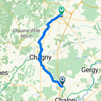
De 25 Rue André Chénier, Chalon-sur-Saône à 39 Rue Saint-Alexandre, Chalon-sur-Saône
A cycling route starting in Champforgeuil, Bourgogne-Franche-Comté, France.
Overview
About this route
- 11 min
- Duration
- 2.2 km
- Distance
- 8 m
- Ascent
- 9 m
- Descent
- 12 km/h
- Avg. speed
- ---
- Max. altitude

Route photos

Route quality
Waytypes & surfaces along the route
Waytypes
Quiet road
0.3 km
(16 %)
Road
0.2 km
(7 %)
Undefined
1.7 km
(77 %)
Surfaces
Paved
1.4 km
(66 %)
Asphalt
1.4 km
(66 %)
Undefined
0.7 km
(34 %)
Continue with Bikemap
Use, edit, or download this cycling route
You would like to ride De 25 Rue André Chénier, Chalon-sur-Saône à 39 Rue Saint-Alexandre, Chalon-sur-Saône or customize it for your own trip? Here is what you can do with this Bikemap route:
Free features
- Save this route as favorite or in collections
- Copy & plan your own version of this route
- Sync your route with Garmin or Wahoo
Premium features
Free trial for 3 days, or one-time payment. More about Bikemap Premium.
- Navigate this route on iOS & Android
- Export a GPX / KML file of this route
- Create your custom printout (try it for free)
- Download this route for offline navigation
Discover more Premium features.
Get Bikemap PremiumFrom our community
Other popular routes starting in Champforgeuil
 chalon - espagne
- Distance
- 880.2 km
- Ascent
- 345 m
- Descent
- 529 m
- Location
- Champforgeuil, Bourgogne-Franche-Comté, France
 Bourgogne dijon
- Distance
- 195 km
- Ascent
- 222 m
- Descent
- 224 m
- Location
- Champforgeuil, Bourgogne-Franche-Comté, France
 Rit A12 Cluny - Chalon-sur-Saone
- Distance
- 49.6 km
- Ascent
- 290 m
- Descent
- 248 m
- Location
- Champforgeuil, Bourgogne-Franche-Comté, France
 De 3 Rue du Quart, Fragnes à Chemin du Pâquier, Crissey
- Distance
- 5.1 km
- Ascent
- 16 m
- Descent
- 25 m
- Location
- Champforgeuil, Bourgogne-Franche-Comté, France
 46.817° N 4.840° W à 46.772° N 4.867° W
- Distance
- 9.2 km
- Ascent
- 26 m
- Descent
- 32 m
- Location
- Champforgeuil, Bourgogne-Franche-Comté, France
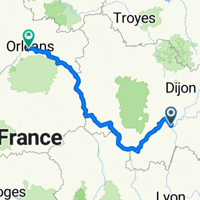 orleans to chalon - EV 6
- Distance
- 427.3 km
- Ascent
- 311 m
- Descent
- 378 m
- Location
- Champforgeuil, Bourgogne-Franche-Comté, France
 Mulhouse-Rhone
- Distance
- 325.9 km
- Ascent
- 257 m
- Descent
- 210 m
- Location
- Champforgeuil, Bourgogne-Franche-Comté, France
 naar Baune
- Distance
- 33.8 km
- Ascent
- 221 m
- Descent
- 186 m
- Location
- Champforgeuil, Bourgogne-Franche-Comté, France
Open it in the app