![[Sion_000] Ferpècle.](/_next/static/media/contour-lines-light-small.cafd5e5d.avif)
![[Sion_000] Ferpècle.](https://media.bikemap.net/routes/7789713/staticmaps/in_e61a264b-4e7c-4da2-b015-8aee9f17235d_694x400_bikemap-2021-3D-static.png)
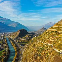
Overview
About this route
- -:--
- Duration
- 81.6 km
- Distance
- 1,981 m
- Ascent
- 1,981 m
- Descent
- ---
- Avg. speed
- ---
- Max. altitude

Part of
Autour de Sion.
9 stages
Route quality
Waytypes & surfaces along the route
Waytypes
Road
49 km
(60 %)
Quiet road
12.2 km
(15 %)
Surfaces
Paved
40.8 km
(50 %)
Asphalt
40.8 km
(50 %)
Undefined
40.8 km
(50 %)
Continue with Bikemap
Use, edit, or download this cycling route
You would like to ride [Sion_000] Ferpècle. or customize it for your own trip? Here is what you can do with this Bikemap route:
Free features
- Save this route as favorite or in collections
- Copy & plan your own version of this route
- Split it into stages to create a multi-day tour
- Sync your route with Garmin or Wahoo
Premium features
Free trial for 3 days, or one-time payment. More about Bikemap Premium.
- Navigate this route on iOS & Android
- Export a GPX / KML file of this route
- Create your custom printout (try it for free)
- Download this route for offline navigation
Discover more Premium features.
Get Bikemap PremiumFrom our community
Other popular routes starting in Sion
 crans montana
- Distance
- 80 km
- Ascent
- 2,218 m
- Descent
- 2,218 m
- Location
- Sion, Valais, Switzerland
 Autour du Mont de l'Arpille
- Distance
- 95.4 km
- Ascent
- 1,352 m
- Descent
- 1,352 m
- Location
- Sion, Valais, Switzerland
 Le Val Ferret
- Distance
- 130.4 km
- Ascent
- 1,786 m
- Descent
- 1,786 m
- Location
- Sion, Valais, Switzerland
 2014-T11-Sion-Aigle
- Distance
- 57.6 km
- Ascent
- 134 m
- Descent
- 218 m
- Location
- Sion, Valais, Switzerland
 CPR mardi
- Distance
- 47.2 km
- Ascent
- 787 m
- Descent
- 241 m
- Location
- Sion, Valais, Switzerland
 CH 511: Sion - Rhône - Brig - Rhône - Reckingen
- Distance
- 97.7 km
- Ascent
- 1,007 m
- Descent
- 183 m
- Location
- Sion, Valais, Switzerland
 CPR DFérailleurs du Rhône 4 mai 2013
- Distance
- 48.7 km
- Ascent
- 633 m
- Descent
- 634 m
- Location
- Sion, Valais, Switzerland
 D16 Sion to Brig climbing route
- Distance
- 108.7 km
- Ascent
- 2,151 m
- Descent
- 1,989 m
- Location
- Sion, Valais, Switzerland
Open it in the app