Full Route In One
- 125.4 km
- 267 m
- 266 m
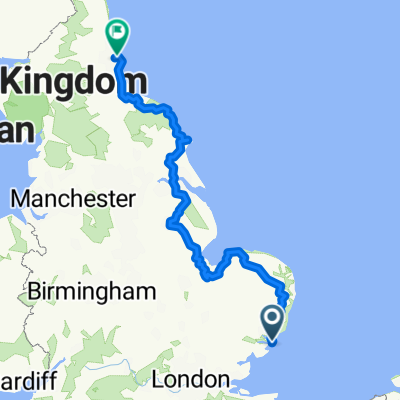
- Felixstowe, England, United Kingdom
A cycling route starting in Felixstowe, England, United Kingdom.
Overview
Car park in Cordy's Lane on right opposite Searson's Farmhouse, past Trimley station and Keeper's Track.
created this 5 years ago
Route quality
Pedestrian area
5.6 km
(58 %)
Cycleway
2.5 km
(26 %)
Paved
0.2 km
(2 %)
Unpaved
5.2 km
(54 %)
Gravel
2.7 km
(28 %)
Unpaved (undefined)
2.5 km
(26 %)
Route highlights
Ship Inn, Levington
Continue with Bikemap
You would like to ride WALK - Trimley St Mary to Levington Ship (A-B 6 miles) or customize it for your own trip? Here is what you can do with this Bikemap route:
Free trial for 3 days, or one-time payment. More about Bikemap Premium.
Discover more Premium features.
Get Bikemap PremiumFrom our community
Open it in the app