

Nagy-Balaton-kör
A cycling route starting in Solymár, Pest County, Hungary.
Overview
About this route
Remetekertváros
Budakeszi
Páty
Zsámbék (ruin church, Zichy castle)
Bicske
Justice for Hungary
Csákvár
Csókakő (castle)
Fehérvárcsurgó (Károlyi castle, reservoir)
Bakonykúti
Várpalota (Thury castle, Zichy castle)
Berhida
Papkeszi
Balatonkenese (lookout tower, Tatar holes, loess cliff)
Balatonfüzfő
Vörösberény
Balatonalmádi (locomotive, Óvári lookout)
Veszprém (castle)
Felsőörs
Káptalanfüred
Balatonfüred
Tihany (ferry, abbey, echo, calvary, Inner Lake)
Örvényes (watermill)
Balatonudvari (heart-shaped tombstones)
Zánka
Hegyestű
Badacsonytördemic
Szigliget (castle)
Queen's skirt
Keszthely (Festetics castle)
Hévíz (lake)
Fenékpuszta (bird rescuers, Roman ruins, row of black pines)
Zalavár (basilica ruins, church ruins, memorial park)
Kis-Balaton (lake, birdwatching, sluice)
Kányavári island
Kápolnapuszta buffalo reserve
Vörs (Star castle)
Balatonszentgyörgy
Fonyód (Castle Hill)
Balatonboglár (sphere lookout)
Balatonszárszó (József Attila memorial)
Balatonföldvár
Köröshegy valley bridge
Szántód (ferry)
Siófok (pier)
Sóstó
Balatonaliga (Club Aliga, high bank)
Balatonakarattya (loess cliff)
Balatonfőkajár
Polgárdi
Jenő
Nádasdladány (Nádasdy castle)
Sárszentmihály (Zichy-Szterényi castle)
Székesfehérvár (downtown, ruin park, Bory castle)
Lake Velence (southern shore)
Agárd (Gárdonyi birthplace, Nádasdy castle)
Velence (Hauszmann-Gschwindt castle)
Nadap (reference points, ancient massif)
Lovasberény
Alcsútdoboz (arboretum)
Etyek (film studio)
Biatorbágy (lake, viaduct)
Törökbálint
Budaörs
Farkasréti cemetery
Városmajor (baptism chapel)
Sunflower Street experimental housing estate
Hűvösvölgy
Remetekertváros
- -:--
- Duration
- 664.1 km
- Distance
- 1,293 m
- Ascent
- 1,293 m
- Descent
- ---
- Avg. speed
- ---
- Max. altitude

Route quality
Waytypes & surfaces along the route
Waytypes
Quiet road
159.4 km
(24 %)
Cycleway
159.4 km
(24 %)
Surfaces
Paved
518 km
(78 %)
Unpaved
26.6 km
(4 %)
Asphalt
511.3 km
(77 %)
Gravel
13.3 km
(2 %)
Route highlights
Points of interest along the route
Point of interest after 156.3 km
Gőzmozdony emlékmű, Balatonalmádi
Continue with Bikemap
Use, edit, or download this cycling route
You would like to ride Nagy-Balaton-kör or customize it for your own trip? Here is what you can do with this Bikemap route:
Free features
- Save this route as favorite or in collections
- Copy & plan your own version of this route
- Split it into stages to create a multi-day tour
- Sync your route with Garmin or Wahoo
Premium features
Free trial for 3 days, or one-time payment. More about Bikemap Premium.
- Navigate this route on iOS & Android
- Export a GPX / KML file of this route
- Create your custom printout (try it for free)
- Download this route for offline navigation
Discover more Premium features.
Get Bikemap PremiumFrom our community
Other popular routes starting in Solymár
 Nagy kör 150km
- Distance
- 149.7 km
- Ascent
- 589 m
- Descent
- 589 m
- Location
- Solymár, Pest County, Hungary
 CRK középtáv 2018
- Distance
- 48.8 km
- Ascent
- 1,207 m
- Descent
- 1,207 m
- Location
- Solymár, Pest County, Hungary
 My Tour
- Distance
- 26 km
- Ascent
- 84 m
- Descent
- 239 m
- Location
- Solymár, Pest County, Hungary
 Solymár-Budakeszi-Bajna-Solymár_90km
- Distance
- 92.6 km
- Ascent
- 676 m
- Descent
- 675 m
- Location
- Solymár, Pest County, Hungary
 Nagy-Balaton-kör
- Distance
- 664.1 km
- Ascent
- 1,293 m
- Descent
- 1,293 m
- Location
- Solymár, Pest County, Hungary
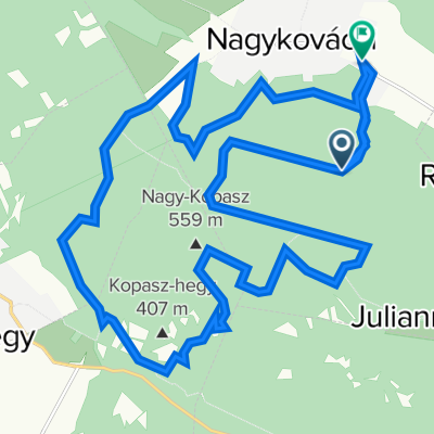 CrossKovácsi 2022 rövid táv
- Distance
- 25 km
- Ascent
- 634 m
- Descent
- 784 m
- Location
- Solymár, Pest County, Hungary
 Crosskovácsi-2013
- Distance
- 50.1 km
- Ascent
- 1,153 m
- Descent
- 1,153 m
- Location
- Solymár, Pest County, Hungary
 Pilis kőkeresztje
- Distance
- 84.2 km
- Ascent
- 1,636 m
- Descent
- 1,772 m
- Location
- Solymár, Pest County, Hungary
Open it in the app