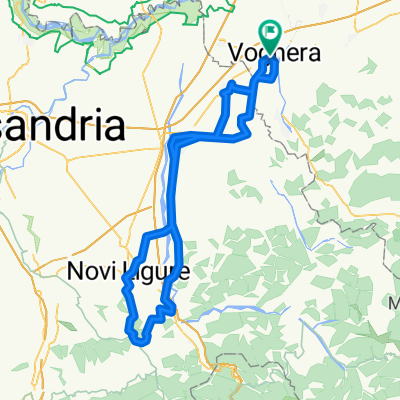
Voghera-Retorbido
A cycling route starting in Voghera, Lombardy, Italy.
Overview
About this route
Here we are at the second stage of the Giro, the first of the road stages... This stage features only one categorized climb, but with a heart-stopping and tricky finish... In the last 1200 meters, the race will enter the town of Retorbido, where the riders will face a slight but constant 4% gradient climb. This finish – which will probably give us the first sprint – will seriously test the riders' speed abilities... The question already buzzing in the group is...: WHICH GEAR TO CHOOSE FOR THIS TOUGH FINISH? The definitive answer will only come from the winner's bike!
- -:--
- Duration
- 38.6 km
- Distance
- 327 m
- Ascent
- 241 m
- Descent
- ---
- Avg. speed
- ---
- Max. altitude
Route quality
Waytypes & surfaces along the route
Waytypes
Quiet road
14.7 km
(38 %)
Road
8.5 km
(22 %)
Surfaces
Paved
10.4 km
(27 %)
Unpaved
0.4 km
(1 %)
Asphalt
10.4 km
(27 %)
Unpaved (undefined)
0.4 km
(1 %)
Undefined
27.8 km
(72 %)
Route highlights
Points of interest along the route
Point of interest after 22 km
Point of interest after 23.1 km
Muro di Cecima
Continue with Bikemap
Use, edit, or download this cycling route
You would like to ride Voghera-Retorbido or customize it for your own trip? Here is what you can do with this Bikemap route:
Free features
- Save this route as favorite or in collections
- Copy & plan your own version of this route
- Sync your route with Garmin or Wahoo
Premium features
Free trial for 3 days, or one-time payment. More about Bikemap Premium.
- Navigate this route on iOS & Android
- Export a GPX / KML file of this route
- Create your custom printout (try it for free)
- Download this route for offline navigation
Discover more Premium features.
Get Bikemap PremiumFrom our community
Other popular routes starting in Voghera
- Voghera - Rocca Susella
- Distance
- 34.2 km
- Ascent
- 516 m
- Descent
- 514 m
- Location
- Voghera, Lombardy, Italy
- Vigneti dell'Oltrepo: Voghera-Stefanago-Voghera
- Distance
- 50.7 km
- Ascent
- 479 m
- Descent
- 476 m
- Location
- Voghera, Lombardy, Italy
- Tra Appennino e Po
- Distance
- 215.6 km
- Ascent
- 978 m
- Descent
- 995 m
- Location
- Voghera, Lombardy, Italy
- 3cime Fortunago Costa Croce Alta Collina
- Distance
- 70.2 km
- Ascent
- 870 m
- Descent
- 868 m
- Location
- Voghera, Lombardy, Italy
- Colline del Gavi _ da Voghera
- Distance
- 104.5 km
- Ascent
- 619 m
- Descent
- 603 m
- Location
- Voghera, Lombardy, Italy
- vogher-stazzano-voghera
- Distance
- 105.7 km
- Ascent
- 1,072 m
- Descent
- 1,071 m
- Location
- Voghera, Lombardy, Italy
- Voghera=>Fortunago
- Distance
- 58.3 km
- Ascent
- 474 m
- Descent
- 470 m
- Location
- Voghera, Lombardy, Italy
- Voghera-Retorbido
- Distance
- 38.6 km
- Ascent
- 327 m
- Descent
- 241 m
- Location
- Voghera, Lombardy, Italy
Open it in the app