

31122010 41km
A cycling route starting in Ingle Farm, South Australia, Australia.
Overview
About this route
Brekky at G Village again?
Could go slightly further north if desired
- -:--
- Duration
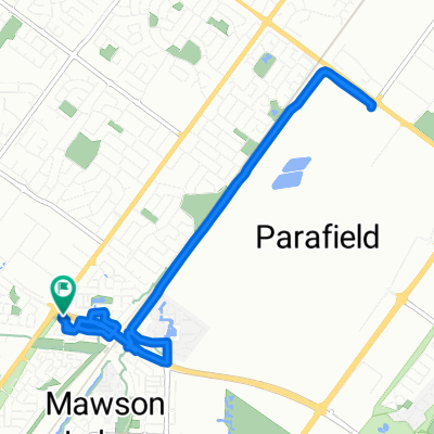
- 41 km
- Distance
- 256 m
- Ascent
- 254 m
- Descent
- ---
- Avg. speed
- ---
- Max. altitude
Continue with Bikemap
Use, edit, or download this cycling route
You would like to ride 31122010 41km or customize it for your own trip? Here is what you can do with this Bikemap route:
Free features
- Save this route as favorite or in collections
- Copy & plan your own version of this route
- Sync your route with Garmin or Wahoo
Premium features
Free trial for 3 days, or one-time payment. More about Bikemap Premium.
- Navigate this route on iOS & Android
- Export a GPX / KML file of this route
- Create your custom printout (try it for free)
- Download this route for offline navigation
Discover more Premium features.
Get Bikemap PremiumFrom our community
Other popular routes starting in Ingle Farm
 Black Top Long Course
- Distance
- 101.2 km
- Ascent
- 717 m
- Descent
- 719 m
- Location
- Ingle Farm, South Australia, Australia
 Dry Creek bike & hiking track - Bridge Road, Walkley Heights to TTP Modbury
- Distance
- 9.7 km
- Ascent
- 107 m
- Descent
- 28 m
- Location
- Ingle Farm, South Australia, Australia
 Dry Creek circuit in Mawson Lakes to Valley View area - SA
- Distance
- 32.6 km
- Ascent
- 213 m
- Descent
- 212 m
- Location
- Ingle Farm, South Australia, Australia
 MLH-One Tree Hill-Gawler-MLH
- Distance
- 72.7 km
- Ascent
- 366 m
- Descent
- 359 m
- Location
- Ingle Farm, South Australia, Australia
 Mawson Lakes Interchange to Parabanks in Salisbury
- Distance
- 7.6 km
- Ascent
- 40 m
- Descent
- 10 m
- Location
- Ingle Farm, South Australia, Australia
 Coventry Street 5, Mawson Lakes to Coventry Street 5, Mawson Lakes
- Distance
- 10.2 km
- Ascent
- 51 m
- Descent
- 47 m
- Location
- Ingle Farm, South Australia, Australia
 3 Saint Kitts Pl, Mawson Lakes to 537–579 Torrens Valley Scenic Dr, Gumeracha
- Distance
- 44.9 km
- Ascent
- 768 m
- Descent
- 425 m
- Location
- Ingle Farm, South Australia, Australia
 Mawson Lakes to Munno Para Wetlands
- Distance
- 20.6 km
- Ascent
- 75 m
- Descent
- 47 m
- Location
- Ingle Farm, South Australia, Australia
Open it in the app