

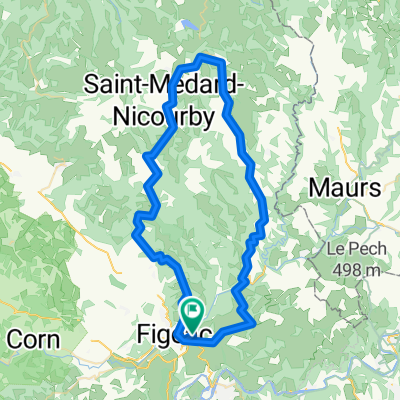
Jakobsweg Etappe 9a Figeac - Cahors im Tal der Célé CLONED FROM ROUTE 519671
A cycling route starting in Figeac, Occitanie, France.
Overview
About this route
Variant along the river valley with a detour to Saint-Cirq-Lapopie (approx. 2+2 km)
- -:--
- Duration
- 87.7 km
- Distance
- 268 m
- Ascent
- 346 m
- Descent
- ---
- Avg. speed
- ---
- Max. altitude
Route quality
Waytypes & surfaces along the route
Waytypes
Quiet road
4.4 km
(5 %)
Path
4.4 km
(5 %)
Surfaces
Paved
46.5 km
(53 %)
Asphalt
45.6 km
(52 %)
Paved (undefined)
0.9 km
(1 %)
Undefined
41.2 km
(47 %)
Continue with Bikemap
Use, edit, or download this cycling route
You would like to ride Jakobsweg Etappe 9a Figeac - Cahors im Tal der Célé CLONED FROM ROUTE 519671 or customize it for your own trip? Here is what you can do with this Bikemap route:
Free features
- Save this route as favorite or in collections
- Copy & plan your own version of this route
- Split it into stages to create a multi-day tour
- Sync your route with Garmin or Wahoo
Premium features
Free trial for 3 days, or one-time payment. More about Bikemap Premium.
- Navigate this route on iOS & Android
- Export a GPX / KML file of this route
- Create your custom printout (try it for free)
- Download this route for offline navigation
Discover more Premium features.
Get Bikemap PremiumFrom our community
Other popular routes starting in Figeac
 J.12. Figeac -Cahors
- Distance
- 81.5 km
- Ascent
- 597 m
- Descent
- 679 m
- Location
- Figeac, Occitanie, France
 Jakobsweg Etappe 9a Figeac - Cahors im Tal der Célé CLONED FROM ROUTE 519671
- Distance
- 87.7 km
- Ascent
- 268 m
- Descent
- 346 m
- Location
- Figeac, Occitanie, France
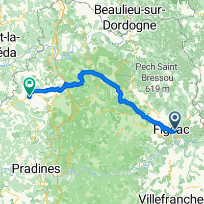
 Figeac > Vers
- Distance
- 68.3 km
- Ascent
- 540 m
- Descent
- 620 m
- Location
- Figeac, Occitanie, France
 DAG 6 17 JULY 2019 Rondrit Figeac -Figeac
- Distance
- 68.5 km
- Ascent
- 853 m
- Descent
- 849 m
- Location
- Figeac, Occitanie, France
 Jakobsweg Etappe 9a Figeac - Cahors im Tal der Célé
- Distance
- 87.7 km
- Ascent
- 268 m
- Descent
- 346 m
- Location
- Figeac, Occitanie, France
 2023 9 - Figeac à Rodez - 66,1km 800D+
- Distance
- 65.9 km
- Ascent
- 990 m
- Descent
- 665 m
- Location
- Figeac, Occitanie, France
 DAG 7 18 JULY 2019 Figeac - Gourdon Camping Le Paradis
- Distance
- 80.8 km
- Ascent
- 752 m
- Descent
- 701 m
- Location
- Figeac, Occitanie, France
 Figeac-Puy-L'Eveque
- Distance
- 127 km
- Ascent
- 1,843 m
- Descent
- 1,921 m
- Location
- Figeac, Occitanie, France
Open it in the app