

Schliersee-Tegernsee
A cycling route starting in Fischbachau, Bavaria, Germany.
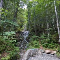
Overview
About this route
From Schliersee to Tegernsee
- -:--
- Duration
- 52.8 km
- Distance
- 962 m
- Ascent
- 1,212 m
- Descent
- ---
- Avg. speed
- 1,097 m
- Max. altitude
Route quality
Waytypes & surfaces along the route
Waytypes
Quiet road
13.7 km
(26 %)
Track
9.5 km
(18 %)
Surfaces
Paved
44.9 km
(85 %)
Unpaved
4.2 km
(8 %)
Asphalt
44.9 km
(85 %)
Gravel
4.2 km
(8 %)
Undefined
3.7 km
(7 %)
Continue with Bikemap
Use, edit, or download this cycling route
You would like to ride Schliersee-Tegernsee or customize it for your own trip? Here is what you can do with this Bikemap route:
Free features
- Save this route as favorite or in collections
- Copy & plan your own version of this route
- Sync your route with Garmin or Wahoo
Premium features
Free trial for 3 days, or one-time payment. More about Bikemap Premium.
- Navigate this route on iOS & Android
- Export a GPX / KML file of this route
- Create your custom printout (try it for free)
- Download this route for offline navigation
Discover more Premium features.
Get Bikemap PremiumFrom our community
Other popular routes starting in Fischbachau
 08-Jaegerkamp-Schneeschuh
- Distance
- 11.6 km
- Ascent
- 694 m
- Descent
- 697 m
- Location
- Fischbachau, Bavaria, Germany
 Übern Spitzingsattel zur Oberen Schönfeldalm
- Distance
- 19.6 km
- Ascent
- 870 m
- Descent
- 844 m
- Location
- Fischbachau, Bavaria, Germany
 Leitzachtaler Bergblickweg
- Distance
- 12.2 km
- Ascent
- 198 m
- Descent
- 176 m
- Location
- Fischbachau, Bavaria, Germany
 Spitzingsee - Hammer - Zipflwirt - Valepp - Spitzingsee
- Distance
- 44.4 km
- Ascent
- 737 m
- Descent
- 781 m
- Location
- Fischbachau, Bavaria, Germany
 Von Neuhaus über den Soinsee zum Rotwandhaus
- Distance
- 29.4 km
- Ascent
- 1,059 m
- Descent
- 1,059 m
- Location
- Fischbachau, Bavaria, Germany
 Rund um den Breitenstein
- Distance
- 19.9 km
- Ascent
- 1,027 m
- Descent
- 1,027 m
- Location
- Fischbachau, Bavaria, Germany
 Rottach-Spitzing-Sudelfeld-Tatzelwurm-Runde
- Distance
- 114.8 km
- Ascent
- 1,442 m
- Descent
- 1,442 m
- Location
- Fischbachau, Bavaria, Germany
 Von Neuhaus über den Soinsee zum Rotwandhaus
- Distance
- 29.4 km
- Ascent
- 1,013 m
- Descent
- 1,013 m
- Location
- Fischbachau, Bavaria, Germany
Open it in the app