

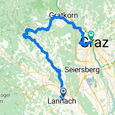
Radteam Lannach Gemeinderadtag am 29. Mai 2011 (Strecke C "CLASSIC", 73 km); ORANGE
A cycling route starting in Lannach, Styria, Austria.
Overview
About this route
START (Lannach Town Hall) - Level crossing - right on Franz Kandler Street - cemetery - left Sajach - Hötschdorf - Mooskirchnerstraße - Neudorf - right Fluttendorf - riding stable - left Schröttenweg - Stögersdorf - Bubendorf - Hallersdorf - right (Fire Station Hallersdorf) - Hallersdorfweg - straight - Auenstraße - roundabout Krottendorf/Gaisfeld - straight old B 70 - Gaisfeld - roundabout Krottendorf - keep left - along bike path - left under bypass road - Erzherzog Johann Straße - keep left - left into Maltesergasse - immediately right Ruhmannstraße - right Arnsteinstraße - roundabout - straight Arnsteinstraße continues - right into Rottenbachergasse - right towards Conrad v. Hötzendorfstraße - left - LKH Voitsberg - up to Packerstraße - right into Oberdorferstraße (L 341) - Voitsbergerstraße - Oberdorf - left towards Bärnbach - roundabout - straight towards Piber (Piberstraße) - Therme Nova (Köflach) - left Köflach Ort - up to Grazerstraße - right into Judenburgerstraße - cross the bypass road - Hauptstraße (short steep climb) - Maria Lankowitz Ort - left into Puchbacherstraße to the municipal office - LAB STATION: in front of the municipal office - golf course - Badesse Piberstein - Werkstraße - up to the intersection with B 70 - left - immediately right into Alois Geißlerstraße - up to the intersection with Sankt Martinerstraße - right along Sankt Martinerstraße - left into Gößnitzstraße - Puchbach - left into Teigitschstraße (Teigitschgraben) - Gaisfeld - intersection Krottendorf - right towards Ligist - Ligist - Steinberg - Hochstraße - Gundersdorf - Neuberg - St. Stefan/Stainz - left towards Pirkhof - Pirkhof - Kniezenberg - sharp right towards Weinberg - right towards Lannach - Völkerweg - right Breitenbachstraße - left Oberblumeggstraße - underpass Radlpaßstraße (B 76) - Hauptstraße - Gasthaus Niggas - right Lannachbergstraße - left Luttenbergerstraße - level crossing - Bahnweg (slight ascent) - left towards Lannach - Weinzettlberg - Kaiserbergstraße - Sparkasse - left into Hauptstraße - Town Hall - FINISH.
- -:--
- Duration
- 72.9 km
- Distance
- 547 m
- Ascent
- 547 m
- Descent
- ---
- Avg. speed
- ---
- Max. altitude
Route quality
Waytypes & surfaces along the route
Waytypes
Quiet road
21.1 km
(29 %)
Road
19 km
(26 %)
Surfaces
Paved
15.3 km
(21 %)
Asphalt
13.1 km
(18 %)
Wood
2.2 km
(3 %)
Undefined
57.6 km
(79 %)
Route highlights
Points of interest along the route
Point of interest after 31.1 km
Labestation: Maria Lankowitz - Ortszentrum (Marktgemeindeamt)
Point of interest after 72.9 km
Start u. Ziel: Rathaus Lannach, Hauptplatz 1
Continue with Bikemap
Use, edit, or download this cycling route
You would like to ride Radteam Lannach Gemeinderadtag am 29. Mai 2011 (Strecke C "CLASSIC", 73 km); ORANGE or customize it for your own trip? Here is what you can do with this Bikemap route:
Free features
- Save this route as favorite or in collections
- Copy & plan your own version of this route
- Sync your route with Garmin or Wahoo
Premium features
Free trial for 3 days, or one-time payment. More about Bikemap Premium.
- Navigate this route on iOS & Android
- Export a GPX / KML file of this route
- Create your custom printout (try it for free)
- Download this route for offline navigation
Discover more Premium features.
Get Bikemap PremiumFrom our community
Other popular routes starting in Lannach
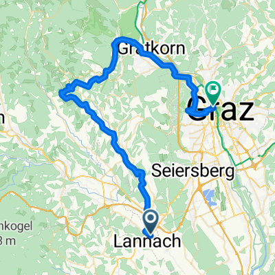
 03 - Lieboch - Graz
- Distance
- 54.9 km
- Ascent
- 630 m
- Descent
- 600 m
- Location
- Lannach, Styria, Austria
 2. Lannacher Radtag am 17. Juni 2012 - Strecke B
- Distance
- 81.7 km
- Ascent
- 655 m
- Descent
- 652 m
- Location
- Lannach, Styria, Austria
 03 - Lieboch - Graz (über Rein)
- Distance
- 56.3 km
- Ascent
- 864 m
- Descent
- 834 m
- Location
- Lannach, Styria, Austria
 3. Lannacher Radtag am 2.6.2013 "Strecke C" - RADMARATHON
- Distance
- 90.8 km
- Ascent
- 664 m
- Descent
- 664 m
- Location
- Lannach, Styria, Austria
 Weststeiermark
- Distance
- 21.1 km
- Ascent
- 661 m
- Descent
- 403 m
- Location
- Lannach, Styria, Austria
 Hauptstraße 68, Heuholz nach Hauptstraße 68, Heuholz
- Distance
- 40.3 km
- Ascent
- 715 m
- Descent
- 714 m
- Location
- Lannach, Styria, Austria

 2. Lannacher Radmarathon am 17.6.2012 - Strecke B
- Distance
- 81.7 km
- Ascent
- 647 m
- Descent
- 644 m
- Location
- Lannach, Styria, Austria
Open it in the app