

Podkarpackie XC/Enduro - Trudna Trasa
A cycling route starting in Rzeszów, Subcarpathian Voivodeship, Poland.
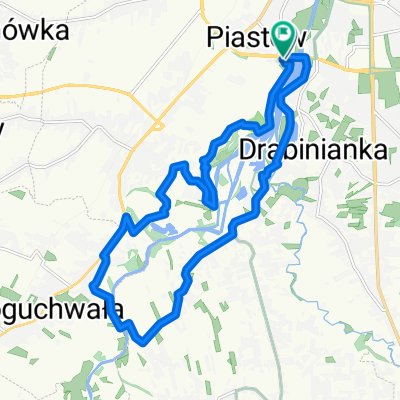
Overview
About this route
Kwintesencja Podkarpackiej jazdy:)
Ciężka trasa dla mocnych nóg i mocnych rowerów. Raczej całodzienna, zważywszy na dystans jaki trzeba pokonać.
Maratonowa trasa XC z elementami Enduro i trochę szosy (starałem sie by było jej jak najmniej)
Do zaliczenia w tym roku.
- -:--
- Duration
- 126.9 km
- Distance
- 1,392 m
- Ascent
- 1,392 m
- Descent
- ---
- Avg. speed
- ---
- Max. altitude
Route highlights
Points of interest along the route
Point of interest after 10.3 km
Teren - początek
Point of interest after 12.3 km
Przystanek rowerowy
Point of interest after 17 km
Krzyż Milenijny (punkt widokowy)
Point of interest after 23.7 km
Przystanek z ogniskiem
Point of interest after 23.8 km
Zjazd szutrowo-ziemny
Point of interest after 36.9 km
Teren ziemisty
Point of interest after 43.4 km
Schron kolejowy
Point of interest after 61.4 km
Odwiert ropy naftowej
Continue with Bikemap
Use, edit, or download this cycling route
You would like to ride Podkarpackie XC/Enduro - Trudna Trasa or customize it for your own trip? Here is what you can do with this Bikemap route:
Free features
- Save this route as favorite or in collections
- Copy & plan your own version of this route
- Split it into stages to create a multi-day tour
- Sync your route with Garmin or Wahoo
Premium features
Free trial for 3 days, or one-time payment. More about Bikemap Premium.
- Navigate this route on iOS & Android
- Export a GPX / KML file of this route
- Create your custom printout (try it for free)
- Download this route for offline navigation
Discover more Premium features.
Get Bikemap PremiumFrom our community
Other popular routes starting in Rzeszów
 Rzeszów, Terliczka, Czarna, Łańcut, Kraczkowa, Malawa, Rzeszów
- Distance
- 43 km
- Ascent
- 119 m
- Descent
- 122 m
- Location
- Rzeszów, Subcarpathian Voivodeship, Poland
 Rzeszów Skandia Maraton Lang Team 2010 Mini
- Distance
- 31.1 km
- Ascent
- 477 m
- Descent
- 480 m
- Location
- Rzeszów, Subcarpathian Voivodeship, Poland
 Zalew Czyste, Grodzisko dolne
- Distance
- 90.2 km
- Ascent
- 62 m
- Descent
- 62 m
- Location
- Rzeszów, Subcarpathian Voivodeship, Poland
 Trasa na niedzielę
- Distance
- 48.8 km
- Ascent
- 155 m
- Descent
- 156 m
- Location
- Rzeszów, Subcarpathian Voivodeship, Poland
 Wisząca kładka
- Distance
- 17.6 km
- Ascent
- 114 m
- Descent
- 122 m
- Location
- Rzeszów, Subcarpathian Voivodeship, Poland
 Rzeszów - Dynów po górkach
- Distance
- 94 km
- Ascent
- 857 m
- Descent
- 846 m
- Location
- Rzeszów, Subcarpathian Voivodeship, Poland
 Rzeszów Skandia Maraton Lang Team 2010 Medio
- Distance
- 50.7 km
- Ascent
- 762 m
- Descent
- 768 m
- Location
- Rzeszów, Subcarpathian Voivodeship, Poland
 Boguchwała
- Distance
- 19.4 km
- Ascent
- 71 m
- Descent
- 71 m
- Location
- Rzeszów, Subcarpathian Voivodeship, Poland
Open it in the app