

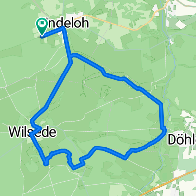
Wilseder Berg
A cycling route starting in Undeloh, Lower Saxony, Germany.
Overview
About this route
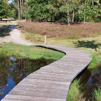
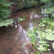
Where once only carriages traveled, directly with the mountain bike in the Lüneburg Heath, but beware only on the path and not cross-country.The mountain is 192 meters high and is the highest in the whole area.
- -:--
- Duration
- 9.2 km
- Distance
- 110 m
- Ascent
- 112 m
- Descent
- ---
- Avg. speed
- ---
- Max. altitude
Continue with Bikemap
Use, edit, or download this cycling route
You would like to ride Wilseder Berg or customize it for your own trip? Here is what you can do with this Bikemap route:
Free features
- Save this route as favorite or in collections
- Copy & plan your own version of this route
- Sync your route with Garmin or Wahoo
Premium features
Free trial for 3 days, or one-time payment. More about Bikemap Premium.
- Navigate this route on iOS & Android
- Export a GPX / KML file of this route
- Create your custom printout (try it for free)
- Download this route for offline navigation
Discover more Premium features.
Get Bikemap PremiumFrom our community
Other popular routes starting in Undeloh
 Meninger Weg nach Meninger Weg
- Distance
- 24.9 km
- Ascent
- 127 m
- Descent
- 167 m
- Location
- Undeloh, Lower Saxony, Germany
 Durch d. Naturpark Lüneburger Heide
- Distance
- 46.2 km
- Ascent
- 371 m
- Descent
- 374 m
- Location
- Undeloh, Lower Saxony, Germany
 Wesel Hanstedt Wesel
- Distance
- 40.1 km
- Ascent
- 248 m
- Descent
- 295 m
- Location
- Undeloh, Lower Saxony, Germany
 Ollsen - Wilseder Berg (Rundkurs)
- Distance
- 35 km
- Ascent
- 236 m
- Descent
- 236 m
- Location
- Undeloh, Lower Saxony, Germany
 Lüneburger Heide
- Distance
- 22.6 km
- Ascent
- 142 m
- Descent
- 140 m
- Location
- Undeloh, Lower Saxony, Germany
 Aussichtspunkt Totengrund – Heide Runde von Undeloh
- Distance
- 18.3 km
- Ascent
- 148 m
- Descent
- 148 m
- Location
- Undeloh, Lower Saxony, Germany
 Radtour Lüneburger Heide
- Distance
- 44.1 km
- Ascent
- 242 m
- Descent
- 241 m
- Location
- Undeloh, Lower Saxony, Germany
 Durch d. Naturpark Lüneburger Heide
- Distance
- 46.2 km
- Ascent
- 397 m
- Descent
- 398 m
- Location
- Undeloh, Lower Saxony, Germany
Open it in the app