

28/12/2020
A cycling route starting in Maruim, Sergipe, Brazil.
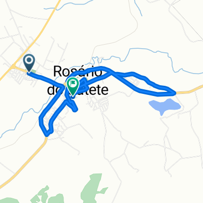
Overview
About this route
- 35 min
- Duration
- 6.9 km
- Distance
- 105 m
- Ascent
- 109 m
- Descent
- 11.7 km/h
- Avg. speed
- ---
- Max. altitude

Continue with Bikemap
Use, edit, or download this cycling route
You would like to ride 28/12/2020 or customize it for your own trip? Here is what you can do with this Bikemap route:
Free features
- Save this route as favorite or in collections
- Copy & plan your own version of this route
- Sync your route with Garmin or Wahoo
Premium features
Free trial for 3 days, or one-time payment. More about Bikemap Premium.
- Navigate this route on iOS & Android
- Export a GPX / KML file of this route
- Create your custom printout (try it for free)
- Download this route for offline navigation
Discover more Premium features.
Get Bikemap PremiumFrom our community
Other popular routes starting in Maruim
 Maruim jatoba
- Distance
- 50.2 km
- Ascent
- 699 m
- Descent
- 719 m
- Location
- Maruim, Sergipe, Brazil
 30/12/2020
- Distance
- 8.5 km
- Ascent
- 135 m
- Descent
- 131 m
- Location
- Maruim, Sergipe, Brazil
 De Rua Genole Ferreira da Mota 145 a SE-431
- Distance
- 11.3 km
- Ascent
- 19 m
- Descent
- 56 m
- Location
- Maruim, Sergipe, Brazil
 De Rua Santa Teresinha a Rua A
- Distance
- 8.9 km
- Ascent
- 78 m
- Descent
- 75 m
- Location
- Maruim, Sergipe, Brazil
 18/01/21
- Distance
- 11.4 km
- Ascent
- 2 m
- Descent
- 4 m
- Location
- Maruim, Sergipe, Brazil
 22/01/21
- Distance
- 15.1 km
- Ascent
- 4 m
- Descent
- 3 m
- Location
- Maruim, Sergipe, Brazil
 Rosário do Catete, 05/04/21
- Distance
- 15.5 km
- Ascent
- 124 m
- Descent
- 136 m
- Location
- Maruim, Sergipe, Brazil
 Maruim x Monte Carmelo
- Distance
- 58.6 km
- Ascent
- 1,604 m
- Descent
- 1,615 m
- Location
- Maruim, Sergipe, Brazil
Open it in the app