

Loop Forrie, Kelmscott, Burswood
A cycling route starting in East Cannington, Western Australia, Australia.
Overview
About this route
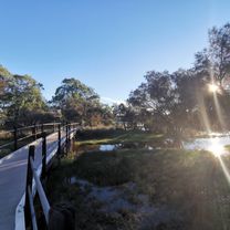
Nice little ride, a country feel to it.
- -:--
- Duration
- 44.3 km
- Distance
- 254 m
- Ascent
- 254 m
- Descent
- ---
- Avg. speed
- ---
- Max. altitude
Route quality
Waytypes & surfaces along the route
Waytypes
Cycleway
15.9 km
(36 %)
Path
13.3 km
(30 %)
Surfaces
Paved
41.2 km
(93 %)
Asphalt
27 km
(61 %)
Paved (undefined)
14.2 km
(32 %)
Undefined
3.1 km
(7 %)
Continue with Bikemap
Use, edit, or download this cycling route
You would like to ride Loop Forrie, Kelmscott, Burswood or customize it for your own trip? Here is what you can do with this Bikemap route:
Free features
- Save this route as favorite or in collections
- Copy & plan your own version of this route
- Sync your route with Garmin or Wahoo
Premium features
Free trial for 3 days, or one-time payment. More about Bikemap Premium.
- Navigate this route on iOS & Android
- Export a GPX / KML file of this route
- Create your custom printout (try it for free)
- Download this route for offline navigation
Discover more Premium features.
Get Bikemap PremiumFrom our community
Other popular routes starting in East Cannington
 Beckenham to Garvey Park Round trip
- Distance
- 30.2 km
- Ascent
- 106 m
- Descent
- 106 m
- Location
- East Cannington, Western Australia, Australia
 43 Lewis Rd, Wattle Grove to 332 Hardey Rd, Cloverdale
- Distance
- 17.8 km
- Ascent
- 176 m
- Descent
- 194 m
- Location
- East Cannington, Western Australia, Australia
 Through Kalamunda
- Distance
- 80.2 km
- Ascent
- 850 m
- Descent
- 851 m
- Location
- East Cannington, Western Australia, Australia
 Tonkin Highway, Forrestfield to 12–14 Hehir Street, Belmont
- Distance
- 11.3 km
- Ascent
- 0 m
- Descent
- 10 m
- Location
- East Cannington, Western Australia, Australia
 Forest field to Mill Point
- Distance
- 17.6 km
- Ascent
- 79 m
- Descent
- 107 m
- Location
- East Cannington, Western Australia, Australia
 Loop Forrie, Kelmscott, Burswood
- Distance
- 44.3 km
- Ascent
- 254 m
- Descent
- 254 m
- Location
- East Cannington, Western Australia, Australia
 10 Yoondarn Elb, Wattle Grove to 27 Marloo St, Wattle Grove
- Distance
- 13.7 km
- Ascent
- 108 m
- Descent
- 106 m
- Location
- East Cannington, Western Australia, Australia
 William Street 152, Beckenham to Queens Park Road 10, Wilson
- Distance
- 7.4 km
- Ascent
- 26 m
- Descent
- 36 m
- Location
- East Cannington, Western Australia, Australia
Open it in the app