

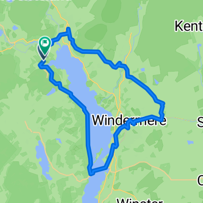
Ambleside Loop, 2 Jan 2011
A cycling route starting in Ambleside, England, United Kingdom.
Overview
About this route
Includes Red Bank, Wrynose Pass, Kirkstone Pass and 'The Struggle'
- -:--
- Duration
- 89.3 km
- Distance
- 1,234 m
- Ascent
- 1,233 m
- Descent
- ---
- Avg. speed
- ---
- Max. altitude

Continue with Bikemap
Use, edit, or download this cycling route
You would like to ride Ambleside Loop, 2 Jan 2011 or customize it for your own trip? Here is what you can do with this Bikemap route:
Free features
- Save this route as favorite or in collections
- Copy & plan your own version of this route
- Split it into stages to create a multi-day tour
- Sync your route with Garmin or Wahoo
Premium features
Free trial for 3 days, or one-time payment. More about Bikemap Premium.
- Navigate this route on iOS & Android
- Export a GPX / KML file of this route
- Create your custom printout (try it for free)
- Download this route for offline navigation
Discover more Premium features.
Get Bikemap PremiumFrom our community
Other popular routes starting in Ambleside
 Fred Whitton Challenge, 9 May 2010 CLONED FROM ROUTE 724662
- Distance
- 172.6 km
- Ascent
- 1,870 m
- Descent
- 1,862 m
- Location
- Ambleside, England, United Kingdom
 B5286, Ambleside do Cooksons Garth, Ambleside
- Distance
- 29.5 km
- Ascent
- 459 m
- Descent
- 459 m
- Location
- Ambleside, England, United Kingdom
 Wigton - Ambleside
- Distance
- 70.7 km
- Ascent
- 1,425 m
- Descent
- 1,580 m
- Location
- Ambleside, England, United Kingdom
 glenridding 1
- Distance
- 75.1 km
- Ascent
- 955 m
- Descent
- 955 m
- Location
- Ambleside, England, United Kingdom
 Actually Modifed Coniston/Windemere loop
- Distance
- 52.8 km
- Ascent
- 557 m
- Descent
- 554 m
- Location
- Ambleside, England, United Kingdom
 Skelwith Fold road end to Skelwith Fold road end
- Distance
- 29.1 km
- Ascent
- 567 m
- Descent
- 569 m
- Location
- Ambleside, England, United Kingdom
 Not Hard and Dry Nose
- Distance
- 41.5 km
- Ascent
- 831 m
- Descent
- 831 m
- Location
- Ambleside, England, United Kingdom
 Tarn Hows Option
- Distance
- 3.6 km
- Ascent
- 174 m
- Descent
- 25 m
- Location
- Ambleside, England, United Kingdom
Open it in the app