bridgeside cottages
A cycling route starting in Jose PaƱganiban, Bicol Region, Philippines.
Overview
About this route
LONG RIDE
- -:--
- Duration
- 43.3 km
- Distance
- 296 m
- Ascent
- 291 m
- Descent
- ---
- Avg. speed
- ---
- Max. altitude
Route quality
Waytypes & surfaces along the route
Waytypes
Road
12.2 km
(28 %)
Busy road
11.9 km
(27 %)
Surfaces
Paved
10.6 km
(25 %)
Asphalt
7.6 km
(18 %)
Concrete
3 km
(7 %)
Undefined
32.6 km
(75 %)
Route highlights
Points of interest along the route
Point of interest after 27.5 km
BAHAY NILA PRES REFILL
Continue with Bikemap
Use, edit, or download this cycling route
You would like to ride bridgeside cottages or customize it for your own trip? Here is what you can do with this Bikemap route:
Free features
- Save this route as favorite or in collections
- Copy & plan your own version of this route
- Sync your route with Garmin or Wahoo
Premium features
Free trial for 3 days, or one-time payment. More about Bikemap Premium.
- Navigate this route on iOS & Android
- Export a GPX / KML file of this route
- Create your custom printout (try it for free)
- Download this route for offline navigation
Discover more Premium features.
Get Bikemap PremiumFrom our community
Other popular routes starting in Jose PaƱganiban
- bridgeside cottages
- Distance
- 43.3 km
- Ascent
- 296 m
- Descent
- 291 m
- Location
- Jose PaƱganiban, Bicol Region, Philippines
- Unnamed Road, Jose Panganiban to Rizal Park, Jose Panganiban
- Distance
- 0.6 km
- Ascent
- 6 m
- Descent
- 5 m
- Location
- Jose PaƱganiban, Bicol Region, Philippines
- Larap - Jose Panganiban Road 262 to Unnamed Road, Jose Panganiban
- Distance
- 4.7 km
- Ascent
- 331 m
- Descent
- 145 m
- Location
- Jose PaƱganiban, Bicol Region, Philippines
- Route to Philippines, Jose Panganiban
- Distance
- 1.1 km
- Ascent
- 46 m
- Descent
- 4 m
- Location
- Jose PaƱganiban, Bicol Region, Philippines
- Camarines Norte, Jose Panganiban to Santa Cruz, Jose Panganiban
- Distance
- 16.8 km
- Ascent
- 563 m
- Descent
- 559 m
- Location
- Jose PaƱganiban, Bicol Region, Philippines
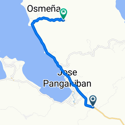
- Unnamed Road, Jose Panganiban to 7JXW+6WX, Jose Panganiban
- Distance
- 7.4 km
- Ascent
- 42 m
- Descent
- 41 m
- Location
- Jose PaƱganiban, Bicol Region, Philippines
- 7MPV+8H9, Jose Panganiban to Rizal Park, Jose Panganiban
- Distance
- 0.6 km
- Ascent
- 6 m
- Descent
- 5 m
- Location
- Jose PaƱganiban, Bicol Region, Philippines
- Ahon matatag
- Distance
- 7 km
- Ascent
- 118 m
- Descent
- 44 m
- Location
- Jose PaƱganiban, Bicol Region, Philippines
Open it in the app