

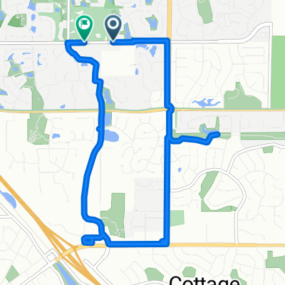
Option Hwy 61 to St. Croix Bluffs Regional Park
A cycling route starting in Saint Paul Park, Minnesota, United States.
Overview
About this route
- -:--
- Duration
- 21.7 km
- Distance
- 106 m
- Ascent
- 94 m
- Descent
- ---
- Avg. speed
- ---
- Max. altitude
Continue with Bikemap
Use, edit, or download this cycling route
You would like to ride Option Hwy 61 to St. Croix Bluffs Regional Park or customize it for your own trip? Here is what you can do with this Bikemap route:
Free features
- Save this route as favorite or in collections
- Copy & plan your own version of this route
- Sync your route with Garmin or Wahoo
Premium features
Free trial for 3 days, or one-time payment. More about Bikemap Premium.
- Navigate this route on iOS & Android
- Export a GPX / KML file of this route
- Create your custom printout (try it for free)
- Download this route for offline navigation
Discover more Premium features.
Get Bikemap PremiumFrom our community
Other popular routes starting in Saint Paul Park
 8460 Delaney Ct, Inver Grove Heights to 8607 W Point Douglas Rd S, Cottage Grove
- Distance
- 20.3 km
- Ascent
- 100 m
- Descent
- 144 m
- Location
- Saint Paul Park, Minnesota, United States
 65th St S, Cottage Grove to 65th St S, Cottage Grove
- Distance
- 9.4 km
- Ascent
- 69 m
- Descent
- 72 m
- Location
- Saint Paul Park, Minnesota, United States
 Option Hwy 61 to St. Croix Bluffs Regional Park
- Distance
- 21.7 km
- Ascent
- 106 m
- Descent
- 94 m
- Location
- Saint Paul Park, Minnesota, United States
 520 Pleasant Ave, Saint Paul Park to 6475 50th St N, Oakdale
- Distance
- 40.6 km
- Ascent
- 329 m
- Descent
- 266 m
- Location
- Saint Paul Park, Minnesota, United States
 Option Cty 22 / 70th St to St. Croix Bluffs Park
- Distance
- 22 km
- Ascent
- 209 m
- Descent
- 199 m
- Location
- Saint Paul Park, Minnesota, United States
 601 Broadway Ave, Saint Paul Park to 601 Broadway Ave, Saint Paul Park
- Distance
- 3.4 km
- Ascent
- 3 m
- Descent
- 7 m
- Location
- Saint Paul Park, Minnesota, United States
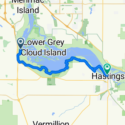 Courthouse Blvd, Inver Grove Heights to Second St E, Hastings
- Distance
- 25.1 km
- Ascent
- 110 m
- Descent
- 178 m
- Location
- Saint Paul Park, Minnesota, United States
Open it in the app