
test kansas
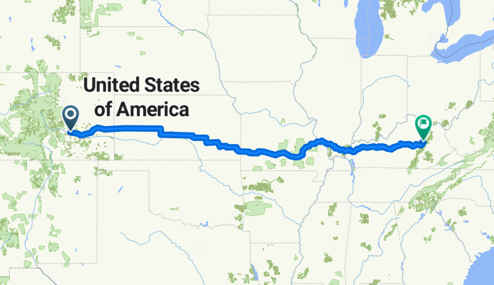
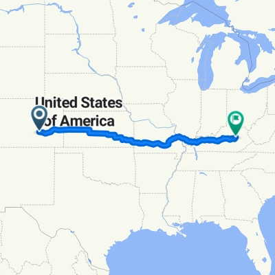
A cycling route starting in Pueblo, Colorado, United States.
Overview
About this route
- -:--
- Duration
- 2,320.3 km
- Distance
- 869 m
- Ascent
- 2,114 m
- Descent
- ---
- Avg. speed
- ---
- Max. altitude

Route quality
Waytypes & surfaces along the route
Waytypes
Busy road
1,329.3 km
(57 %)
Road
466.5 km
(20 %)
Surfaces
Paved
833.6 km
(36 %)
Unpaved
33.9 km
(1 %)
Asphalt
517.2 km
(22 %)
Paved (undefined)
308 km
(13 %)
Continue with Bikemap
Use, edit, or download this cycling route
You would like to ride test kansas or customize it for your own trip? Here is what you can do with this Bikemap route:
Free features
- Save this route as favorite or in collections
- Copy & plan your own version of this route
- Split it into stages to create a multi-day tour
- Sync your route with Garmin or Wahoo
Premium features
Free trial for 3 days, or one-time payment. More about Bikemap Premium.
- Navigate this route on iOS & Android
- Export a GPX / KML file of this route
- Create your custom printout (try it for free)
- Download this route for offline navigation
Discover more Premium features.
Get Bikemap PremiumFrom our community
Other popular routes starting in Pueblo
 Pear Street 641, Pueblo to Pear Street 641, Pueblo
- Distance
- 20.7 km
- Ascent
- 105 m
- Descent
- 81 m
- Location
- Pueblo, Colorado, United States
 Cactus Street 641, Pueblo to Pear Street 641, Pueblo
- Distance
- 14.6 km
- Ascent
- 107 m
- Descent
- 84 m
- Location
- Pueblo, Colorado, United States
 Massari Road 74, Pueblo to Normandy Circle 59, Pueblo
- Distance
- 1 km
- Ascent
- 17 m
- Descent
- 11 m
- Location
- Pueblo, Colorado, United States
 Cornell Circle 89, Pueblo to Cornell Circle 89, Pueblo
- Distance
- 5.3 km
- Ascent
- 4 m
- Descent
- 4 m
- Location
- Pueblo, Colorado, United States
 1st St-Portland Ave, Pueblo to Santa Fe Ave-C St, Pueblo
- Distance
- 6.9 km
- Ascent
- 15 m
- Descent
- 26 m
- Location
- Pueblo, Colorado, United States
 111 N Union Ave, Pueblo to Mathews St, Yorktown
- Distance
- 3,368.5 km
- Ascent
- 35,014 m
- Descent
- 36,422 m
- Location
- Pueblo, Colorado, United States
 test kansas
- Distance
- 2,320.3 km
- Ascent
- 869 m
- Descent
- 2,114 m
- Location
- Pueblo, Colorado, United States
 Pear Street 641, Pueblo to Pear Street 641, Pueblo
- Distance
- 18.2 km
- Ascent
- 73 m
- Descent
- 52 m
- Location
- Pueblo, Colorado, United States
Open it in the app