

Mouning
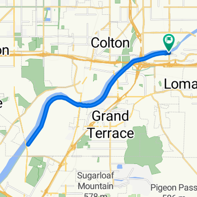
A cycling route starting in Loma Linda, California, United States.
Overview
About this route
mou
- -:--
- Duration
- 45.7 km
- Distance
- 526 m
- Ascent
- 495 m
- Descent
- ---
- Avg. speed
- ---
- Max. altitude

Route quality
Waytypes & surfaces along the route
Waytypes
Road
4.6 km
(10 %)
Quiet road
3.7 km
(8 %)
Surfaces
Paved
10.1 km
(22 %)
Asphalt
9.6 km
(21 %)
Paved (undefined)
0.5 km
(1 %)
Undefined
35.6 km
(78 %)
Continue with Bikemap
Use, edit, or download this cycling route
You would like to ride Mouning or customize it for your own trip? Here is what you can do with this Bikemap route:
Free features
- Save this route as favorite or in collections
- Copy & plan your own version of this route
- Sync your route with Garmin or Wahoo
Premium features
Free trial for 3 days, or one-time payment. More about Bikemap Premium.
- Navigate this route on iOS & Android
- Export a GPX / KML file of this route
- Create your custom printout (try it for free)
- Download this route for offline navigation
Discover more Premium features.
Get Bikemap PremiumFrom our community
Other popular routes starting in Loma Linda
 Snail-like route in San Bernardino
- Distance
- 21.1 km
- Ascent
- 88 m
- Descent
- 91 m
- Location
- Loma Linda, California, United States
 Mouning
- Distance
- 45.7 km
- Ascent
- 526 m
- Descent
- 495 m
- Location
- Loma Linda, California, United States
 Clairemont
- Distance
- 146.3 km
- Ascent
- 374 m
- Descent
- 376 m
- Location
- Loma Linda, California, United States
 river route
- Distance
- 46.5 km
- Ascent
- 1,342 m
- Descent
- 1,355 m
- Location
- Loma Linda, California, United States
 Moderate route in Redlands
- Distance
- 3.1 km
- Ascent
- 36 m
- Descent
- 8 m
- Location
- Loma Linda, California, United States
 South Waterman Avenue 1750, San Bernardino to California Avenue 4886, Norco
- Distance
- 32.7 km
- Ascent
- 281 m
- Descent
- 381 m
- Location
- Loma Linda, California, United States
 DAY 2 L.A - NYC
- Distance
- 125.9 km
- Ascent
- 1,261 m
- Descent
- 802 m
- Location
- Loma Linda, California, United States
 panorama
- Distance
- 32.9 km
- Ascent
- 459 m
- Descent
- 392 m
- Location
- Loma Linda, California, United States
Open it in the app