
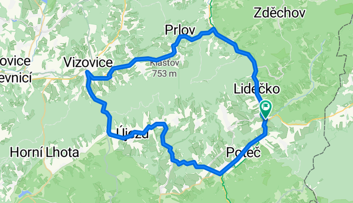
Kolecko po valassku
A cycling route starting in Horní Lideč, Zlín, Czechia.
Overview
About this route
- -:--
- Duration
- 51.4 km
- Distance
- 868 m
- Ascent
- 908 m
- Descent
- ---
- Avg. speed
- 645 m
- Max. altitude
Route quality
Waytypes & surfaces along the route
Waytypes
Busy road
28.1 km
(55 %)
Road
19.7 km
(38 %)
Surfaces
Paved
29.4 km
(57 %)
Unpaved
0.1 km
(<1 %)
Asphalt
29 km
(56 %)
Paved (undefined)
0.4 km
(<1 %)
Continue with Bikemap
Use, edit, or download this cycling route
You would like to ride Kolecko po valassku or customize it for your own trip? Here is what you can do with this Bikemap route:
Free features
- Save this route as favorite or in collections
- Copy & plan your own version of this route
- Sync your route with Garmin or Wahoo
Premium features
Free trial for 3 days, or one-time payment. More about Bikemap Premium.
- Navigate this route on iOS & Android
- Export a GPX / KML file of this route
- Create your custom printout (try it for free)
- Download this route for offline navigation
Discover more Premium features.
Get Bikemap PremiumFrom our community
Other popular routes starting in Horní Lideč
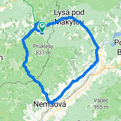 Študlov-Půchov-Nemšová-Študlov
- Distance
- 84.7 km
- Ascent
- 451 m
- Descent
- 451 m
- Location
- Horní Lideč, Zlín, Czechia
 Přejezd slovenských hor 2013
- Distance
- 423.1 km
- Ascent
- 2,506 m
- Descent
- 2,763 m
- Location
- Horní Lideč, Zlín, Czechia
 Střelná-Slavičín-Střelná
- Distance
- 56.1 km
- Ascent
- 450 m
- Descent
- 451 m
- Location
- Horní Lideč, Zlín, Czechia
 2013 - Přejezd slovenských hor
- Distance
- 421.6 km
- Ascent
- 2,462 m
- Descent
- 2,719 m
- Location
- Horní Lideč, Zlín, Czechia
 Študlov-Vsetín-Vizovice-Študlov
- Distance
- 71.7 km
- Ascent
- 543 m
- Descent
- 543 m
- Location
- Horní Lideč, Zlín, Czechia
 Lačnov-Kletné
- Distance
- 109.7 km
- Ascent
- 1,043 m
- Descent
- 1,254 m
- Location
- Horní Lideč, Zlín, Czechia
 Bytca -Horni Lidec-Pulcin -Kohutka-Fram-Melocik-Bytca
- Distance
- 66.8 km
- Ascent
- 932 m
- Descent
- 1,091 m
- Location
- Horní Lideč, Zlín, Czechia
 Horní Lideč - Valašské Klobouky - Horní Srní - Brumov-Bylnice - Bojkovice
- Distance
- 82.1 km
- Ascent
- 1,135 m
- Descent
- 1,242 m
- Location
- Horní Lideč, Zlín, Czechia
Open it in the app