

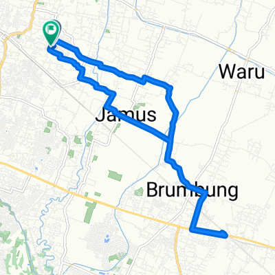
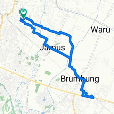
Jalan Fatmawati 73-47, Kecamatan Pedurungan to Mangunharjo, Kecamatan Tembalang
A cycling route starting in Mranggen, Central Java, Indonesia.
Overview
About this route
- 11 min
- Duration
- 5 km
- Distance
- 88 m
- Ascent
- 34 m
- Descent
- 27.5 km/h
- Avg. speed
- ---
- Max. altitude

Route quality
Waytypes & surfaces along the route
Waytypes
Road
2.7 km
(53 %)
Quiet road
1.2 km
(23 %)
Surfaces
Paved
4.6 km
(91 %)
Asphalt
4.1 km
(81 %)
Concrete
0.5 km
(10 %)
Undefined
0.5 km
(9 %)
Continue with Bikemap
Use, edit, or download this cycling route
You would like to ride Jalan Fatmawati 73-47, Kecamatan Pedurungan to Mangunharjo, Kecamatan Tembalang or customize it for your own trip? Here is what you can do with this Bikemap route:
Free features
- Save this route as favorite or in collections
- Copy & plan your own version of this route
- Sync your route with Garmin or Wahoo
Premium features
Free trial for 3 days, or one-time payment. More about Bikemap Premium.
- Navigate this route on iOS & Android
- Export a GPX / KML file of this route
- Create your custom printout (try it for free)
- Download this route for offline navigation
Discover more Premium features.
Get Bikemap PremiumFrom our community
Other popular routes starting in Mranggen
 gasss
gasss- Distance
- 65.6 km
- Ascent
- 90 m
- Descent
- 87 m
- Location
- Mranggen, Central Java, Indonesia
 nyepi bersepeda
- Distance
- 21.8 km
- Ascent
- 526 m
- Descent
- 517 m
- Location
- Mranggen, Central Java, Indonesia
 Sepeda Sehat GBB
- Distance
- 17.3 km
- Ascent
- 23 m
- Descent
- 24 m
- Location
- Mranggen, Central Java, Indonesia
 Rowosari, Kecamatan Tembalang to Jalan Krajan II 99, Kecamatan Tembalang
- Distance
- 10.9 km
- Ascent
- 98 m
- Descent
- 107 m
- Location
- Mranggen, Central Java, Indonesia
 tipis2
- Distance
- 5.4 km
- Ascent
- 105 m
- Descent
- 120 m
- Location
- Mranggen, Central Java, Indonesia
 Rowosari Tembalang Tipis-tipis
- Distance
- 6.3 km
- Ascent
- 65 m
- Descent
- 62 m
- Location
- Mranggen, Central Java, Indonesia
 XFQJ+3V2 to 2F7P+FF6
- Distance
- 7.5 km
- Ascent
- 102 m
- Descent
- 131 m
- Location
- Mranggen, Central Java, Indonesia
 Bangetayu Brumbung
- Distance
- 17.4 km
- Ascent
- 159 m
- Descent
- 191 m
- Location
- Mranggen, Central Java, Indonesia
Open it in the app