

Let's kill the Hill
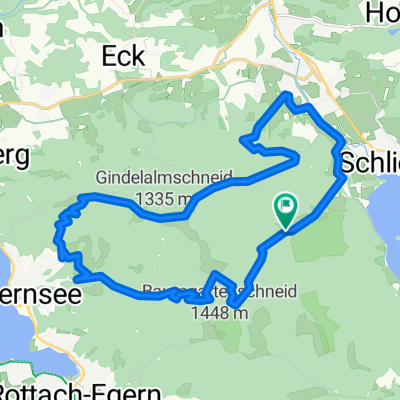
A cycling route starting in Schliersee, Bavaria, Germany.
Overview
About this route
Dies ist eine ziemlich höhenmeterlastige Tour. Die Straßen sind leider zum Teil ziemlich groß, aber die Landschaft ist fantastisch!
Gerade für sportliche Rennradler geeignet!
- -:--
- Duration
- 136.6 km
- Distance
- 1,317 m
- Ascent
- 1,316 m
- Descent
- ---
- Avg. speed
- ---
- Avg. speed
Continue with Bikemap
Use, edit, or download this cycling route
You would like to ride Let's kill the Hill or customize it for your own trip? Here is what you can do with this Bikemap route:
Free features
- Save this route as favorite or in collections
- Copy & plan your own version of this route
- Split it into stages to create a multi-day tour
- Sync your route with Garmin or Wahoo
Premium features
Free trial for 3 days, or one-time payment. More about Bikemap Premium.
- Navigate this route on iOS & Android
- Export a GPX / KML file of this route
- Create your custom printout (try it for free)
- Download this route for offline navigation
Discover more Premium features.
Get Bikemap PremiumFrom our community
Other popular routes starting in Schliersee
 Gindelalm
- Distance
- 34.3 km
- Ascent
- 1,139 m
- Descent
- 1,139 m
- Location
- Schliersee, Bavaria, Germany
 Schliersee - Tegernsee
- Distance
- 23.2 km
- Ascent
- 925 m
- Descent
- 925 m
- Location
- Schliersee, Bavaria, Germany
 Schliersee Tegernsee Rundfahrt
- Distance
- 54.2 km
- Ascent
- 364 m
- Descent
- 364 m
- Location
- Schliersee, Bavaria, Germany
 Schliersee über Valepp zum Tegernsee und zurück
- Distance
- 28.6 km
- Ascent
- 591 m
- Descent
- 641 m
- Location
- Schliersee, Bavaria, Germany
 Schliersee südliche Runde über Spitzingsee
- Distance
- 14.4 km
- Ascent
- 637 m
- Descent
- 634 m
- Location
- Schliersee, Bavaria, Germany
 Valepprunde
- Distance
- 44.9 km
- Ascent
- 1,034 m
- Descent
- 1,031 m
- Location
- Schliersee, Bavaria, Germany
 Dreiseenrunde Schliersee-Tegernsee-Spitzingsee
- Distance
- 52.3 km
- Ascent
- 771 m
- Descent
- 765 m
- Location
- Schliersee, Bavaria, Germany
 Hexal Alpen-Triathlon Radstrecke
- Distance
- 39.4 km
- Ascent
- 734 m
- Descent
- 526 m
- Location
- Schliersee, Bavaria, Germany
Open it in the app