

Mosel-Nahe
A cycling route starting in Treis-Karden, Rhineland-Palatinate, Germany.
Overview
About this route
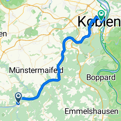
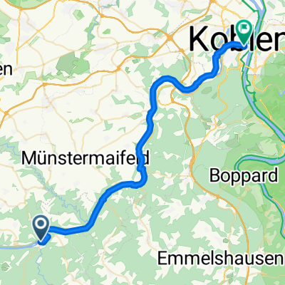
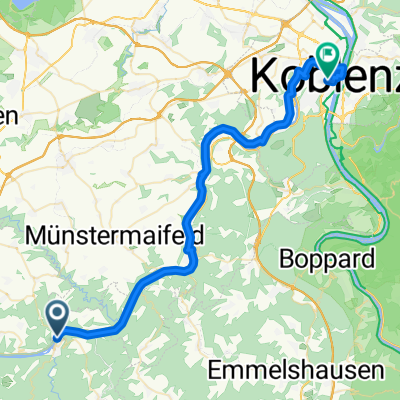
Hunsrück crossing from Treis-Karden in the Moselle Valley to Kirn in the Nahe Valley
- -:--
- Duration
- 80.4 km
- Distance
- 671 m
- Ascent
- 570 m
- Descent
- ---
- Avg. speed
- ---
- Max. altitude
Route quality
Waytypes & surfaces along the route
Waytypes
Track
37 km
(46 %)
Road
12.1 km
(15 %)
Surfaces
Paved
60.3 km
(75 %)
Unpaved
4.8 km
(6 %)
Asphalt
48.2 km
(60 %)
Paved (undefined)
10.4 km
(13 %)
Continue with Bikemap
Use, edit, or download this cycling route
You would like to ride Mosel-Nahe or customize it for your own trip? Here is what you can do with this Bikemap route:
Free features
- Save this route as favorite or in collections
- Copy & plan your own version of this route
- Split it into stages to create a multi-day tour
- Sync your route with Garmin or Wahoo
Premium features
Free trial for 3 days, or one-time payment. More about Bikemap Premium.
- Navigate this route on iOS & Android
- Export a GPX / KML file of this route
- Create your custom printout (try it for free)
- Download this route for offline navigation
Discover more Premium features.
Get Bikemap PremiumFrom our community
Other popular routes starting in Treis-Karden
 Treis-Karden - Weißenthurm
- Distance
- 42.5 km
- Ascent
- 566 m
- Descent
- 580 m
- Location
- Treis-Karden, Rhineland-Palatinate, Germany
 MoselClassic E5 TraisKarden-Koblenz
- Distance
- 41.4 km
- Ascent
- 116 m
- Descent
- 128 m
- Location
- Treis-Karden, Rhineland-Palatinate, Germany
 Hauptstraße 36, Treis-Karden nach Bahnhofplatz, Koblenz
- Distance
- 40.1 km
- Ascent
- 630 m
- Descent
- 642 m
- Location
- Treis-Karden, Rhineland-Palatinate, Germany
 Mosel-Nahe
- Distance
- 80.4 km
- Ascent
- 671 m
- Descent
- 570 m
- Location
- Treis-Karden, Rhineland-Palatinate, Germany
 MoselXL E9 TreisKarden-BurgEltz-Koblenz
- Distance
- 44.2 km
- Ascent
- 143 m
- Descent
- 162 m
- Location
- Treis-Karden, Rhineland-Palatinate, Germany
 Burg Eltz
- Distance
- 10.3 km
- Ascent
- 220 m
- Descent
- 187 m
- Location
- Treis-Karden, Rhineland-Palatinate, Germany
 tk-bla-ze
- Distance
- 92.3 km
- Ascent
- 979 m
- Descent
- 978 m
- Location
- Treis-Karden, Rhineland-Palatinate, Germany
 Day4 to Koblenz
- Distance
- 43.1 km
- Ascent
- 566 m
- Descent
- 581 m
- Location
- Treis-Karden, Rhineland-Palatinate, Germany
Open it in the app