

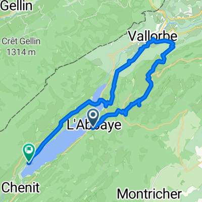
La Vallée de Joux en gravel: La grande sortie
A cycling route starting in L'Abbaye, Canton of Vaud, Switzerland.
Overview
About this route
1
- -:--
- Duration
- 66.3 km
- Distance
- 1,454 m
- Ascent
- 1,452 m
- Descent
- ---
- Avg. speed
- ---
- Max. altitude
Cycliste.ch - Le site des cyclistes romands
created this 5 years ago
Route quality
Waytypes & surfaces along the route
Waytypes
Track
27.2 km
41 %
Path
13.9 km
21 %
Surfaces
Paved
23.9 km
(36 %)
Unpaved
19.2 km
(29 %)
Asphalt
17.2 km
26 %
Ground
8.6 km
13 %
Continue with Bikemap
Use, edit, or download this cycling route
You would like to ride La Vallée de Joux en gravel: La grande sortie or customize it for your own trip? Here is what you can do with this Bikemap route:
Free features
- Save this route as favorite or in collections
- Copy & plan your own version of this route
- Sync your route with Garmin or Wahoo
Premium features
Free trial for 3 days, or one-time payment. More about Bikemap Premium.
- Navigate this route on iOS & Android
- Export a GPX / KML file of this route
- Create your custom printout (try it for free)
- Download this route for offline navigation
Discover more Premium features.
Get Bikemap PremiumFrom our community
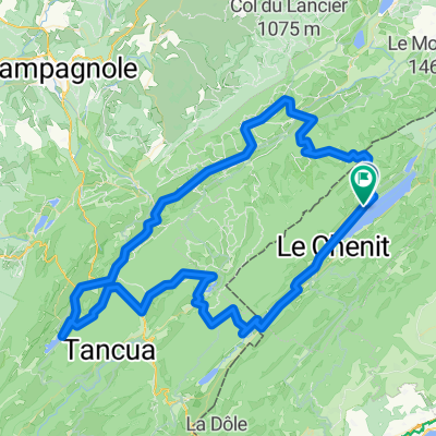
Other popular routes starting in L'Abbaye
- P-Petite Echelle-Les Fourgs-St-Point-Mouthe0
- 95.1 km
- 1,628 m
- 1,630 m
- L'Abbaye, Canton of Vaud, Switzerland


Open it in the app