

SZKLARSKA - Harrachov - k/ŚWIERADÓW - Szklarska
A cycling route starting in Szklarska Poręba, Lower Silesian Voivodeship, Poland.
Overview
About this route
<p><strong>alternative:</strong></p>
<p><strong>instead of segment 290 (Cerna Ricka and Lake Sous) segment: Polubny->Jizerka->290->Bily Potok</strong></p>
Translated, show original (Polish)- -:--
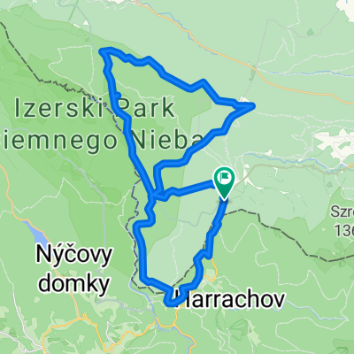
- Duration
- 91 km
- Distance
- 1,288 m
- Ascent
- 1,318 m
- Descent
- ---
- Avg. speed
- ---
- Max. altitude

Continue with Bikemap
Use, edit, or download this cycling route
You would like to ride SZKLARSKA - Harrachov - k/ŚWIERADÓW - Szklarska or customize it for your own trip? Here is what you can do with this Bikemap route:
Free features
- Save this route as favorite or in collections
- Copy & plan your own version of this route
- Split it into stages to create a multi-day tour
- Sync your route with Garmin or Wahoo
Premium features
Free trial for 3 days, or one-time payment. More about Bikemap Premium.
- Navigate this route on iOS & Android
- Export a GPX / KML file of this route
- Create your custom printout (try it for free)
- Download this route for offline navigation
Discover more Premium features.
Get Bikemap PremiumFrom our community
Other popular routes starting in Szklarska Poręba
 SZKLARSKA - Harrachov - k/ŚWIERADÓW - Szklarska
- Distance
- 91 km
- Ascent
- 1,288 m
- Descent
- 1,318 m
- Location
- Szklarska Poręba, Lower Silesian Voivodeship, Poland
 Szklarska Poreba - No. 8
- Distance
- 34.7 km
- Ascent
- 606 m
- Descent
- 623 m
- Location
- Szklarska Poręba, Lower Silesian Voivodeship, Poland
 Izery
Izery- Distance
- 38.9 km
- Ascent
- 633 m
- Descent
- 634 m
- Location
- Szklarska Poręba, Lower Silesian Voivodeship, Poland
 Szklarska Poręba - Zwalisko - Przednia Kopa- Chatka Górzystów
- Distance
- 31.5 km
- Ascent
- 619 m
- Descent
- 618 m
- Location
- Szklarska Poręba, Lower Silesian Voivodeship, Poland
 3 Countries v.1.
- Distance
- 390.1 km
- Ascent
- 7,596 m
- Descent
- 7,585 m
- Location
- Szklarska Poręba, Lower Silesian Voivodeship, Poland
 Izery - lite
- Distance
- 27.7 km
- Ascent
- 272 m
- Descent
- 272 m
- Location
- Szklarska Poręba, Lower Silesian Voivodeship, Poland
 Fluggaenkoecchicebolsen
- Distance
- 279.5 km
- Ascent
- 428 m
- Descent
- 974 m
- Location
- Szklarska Poręba, Lower Silesian Voivodeship, Poland
 Jakuszyce
- Distance
- 40.1 km
- Ascent
- 677 m
- Descent
- 677 m
- Location
- Szklarska Poręba, Lower Silesian Voivodeship, Poland
Open it in the app