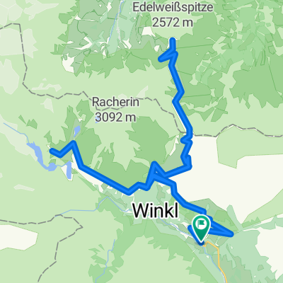
Wien - Ljubljana - Salzburg - Wien (2020)
Heiligenblut - Schwarzach
A cycling route starting in Heiligenblut am Großglockner, Carinthia, Austria.
Overview
About this route
Wien - Ljubljana - Salzburg - Wien, Tag 8/13
Routensammlung Wien - Ljubljana - Salzburg - Wien
Tag 7: Paternion - Heiligenblut
Tag 9: Schwarzach - St. Lorenz
- -:--
- Duration
- 78.7 km
- Distance
- 1,568 m
- Ascent
- 2,202 m
- Descent
- ---
- Avg. speed
- ---
- Max. altitude
Part of
Route photos
Route quality
Waytypes & surfaces along the route
Waytypes
Road
46.4 km
(59 %)
Quiet road
15.5 km
(20 %)
Surfaces
Paved
76.5 km
(97 %)
Unpaved
0.5 km
(<1 %)
Asphalt
76.3 km
(97 %)
Pebblestone
0.2 km
(<1 %)
Continue with Bikemap
Use, edit, or download this cycling route
You would like to ride Heiligenblut - Schwarzach or customize it for your own trip? Here is what you can do with this Bikemap route:
Free features
- Save this route as favorite or in collections
- Copy & plan your own version of this route
- Sync your route with Garmin or Wahoo
Premium features
Free trial for 3 days, or one-time payment. More about Bikemap Premium.
- Navigate this route on iOS & Android
- Export a GPX / KML file of this route
- Create your custom printout (try it for free)
- Download this route for offline navigation
Discover more Premium features.
Get Bikemap PremiumFrom our community
Other popular routes starting in Heiligenblut am Großglockner
- Heiligenblut - Ragga szurdok - Möllbrücke
- Distance
- 76 km
- Ascent
- 132 m
- Descent
- 858 m
- Location
- Heiligenblut am Großglockner, Carinthia, Austria
- 4 Grossglockner - Salisburgo
- Distance
- 131.7 km
- Ascent
- 495 m
- Descent
- 2,357 m
- Location
- Heiligenblut am Großglockner, Carinthia, Austria
- Chiemsee - Gardasee - Etappe 2
- Distance
- 331.8 km
- Ascent
- 2,933 m
- Descent
- 5,291 m
- Location
- Heiligenblut am Großglockner, Carinthia, Austria
- NR-24 Großglockner -Roas /2
- Distance
- 417.3 km
- Ascent
- 4,112 m
- Descent
- 5,308 m
- Location
- Heiligenblut am Großglockner, Carinthia, Austria
- Rasa
- Distance
- 47.5 km
- Ascent
- 141 m
- Descent
- 726 m
- Location
- Heiligenblut am Großglockner, Carinthia, Austria
- Gravel Austria, Etappe Salzburg II
- Distance
- 87.4 km
- Ascent
- 757 m
- Descent
- 2,027 m
- Location
- Heiligenblut am Großglockner, Carinthia, Austria
- RR-Berg: Heiligenblut-Edelweissspitze/Grossglockner-Bad Gastein
- Distance
- 96.9 km
- Ascent
- 3,132 m
- Descent
- 3,300 m
- Location
- Heiligenblut am Großglockner, Carinthia, Austria
- Heilgenblut - Hochtor - Edelweisspitz - Fusch - Zeller See (část CT2009)
- Distance
- 65.8 km
- Ascent
- 2,442 m
- Descent
- 2,914 m
- Location
- Heiligenblut am Großglockner, Carinthia, Austria
Open it in the app