

Not Hard and Dry Nose
A cycling route starting in Ambleside, England, United Kingdom.
Overview
About this route
Not for the faint Hearted - or the weak hearted!
Some hard climbs rewarded with fast descents on narrow roads
Only one short section of off=-road - just south of Little Langdale - which can be circum navigated for road bikes.
- -:--
- Duration
- 41.5 km
- Distance
- 831 m
- Ascent
- 831 m
- Descent
- ---
- Avg. speed
- ---
- Max. altitude

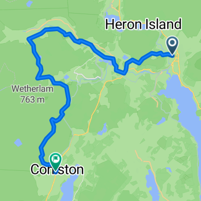
Route highlights
Points of interest along the route
Point of interest after 0 km
Conniston Car Park
Point of interest after 0.2 km
Join A593
Point of interest after 2.6 km
Turn off A593
Point of interest after 4 km
Via
Point of interest after 6.1 km
Turn left along track
Point of interest after 6.6 km
Care at the Ford (Not passable when the river is in flood - If in doubt return to the last way point and rejoin the A593 North of Oxen Fell and take the next left turn to Little Langdale
Point of interest after 7.2 km
Turn left in Little Langdale
Point of interest after 16.1 km
Keep Left at Cockley Beck
Continue with Bikemap
Use, edit, or download this cycling route
You would like to ride Not Hard and Dry Nose or customize it for your own trip? Here is what you can do with this Bikemap route:
Free features
- Save this route as favorite or in collections
- Copy & plan your own version of this route
- Sync your route with Garmin or Wahoo
Premium features
Free trial for 3 days, or one-time payment. More about Bikemap Premium.
- Navigate this route on iOS & Android
- Export a GPX / KML file of this route
- Create your custom printout (try it for free)
- Download this route for offline navigation
Discover more Premium features.
Get Bikemap PremiumFrom our community
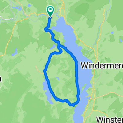
Other popular routes starting in Ambleside
 Not Hard and Dry Nose
- Distance
- 41.5 km
- Ascent
- 831 m
- Descent
- 831 m
- Location
- Ambleside, England, United Kingdom
 Actually Modifed Coniston/Windemere loop
- Distance
- 52.8 km
- Ascent
- 557 m
- Descent
- 554 m
- Location
- Ambleside, England, United Kingdom
 2023 Cp 13 to 15 Ambleside to Coniston
- Distance
- 24 km
- Ascent
- 1,204 m
- Descent
- 1,199 m
- Location
- Ambleside, England, United Kingdom
 Badger Wheel, Ambleside do Badger Wheel, Ambleside
- Distance
- 23.2 km
- Ascent
- 417 m
- Descent
- 417 m
- Location
- Ambleside, England, United Kingdom
 LEJO'G 14B Ambleside Loop
- Distance
- 75.6 km
- Ascent
- 1,572 m
- Descent
- 1,573 m
- Location
- Ambleside, England, United Kingdom
 Wigton - Ambleside
- Distance
- 70.7 km
- Ascent
- 1,425 m
- Descent
- 1,580 m
- Location
- Ambleside, England, United Kingdom
 Grizedale i dookoła Coniston Water.
- Distance
- 46.7 km
- Ascent
- 619 m
- Descent
- 628 m
- Location
- Ambleside, England, United Kingdom
 B5286, Ambleside do Cooksons Garth, Ambleside
- Distance
- 29.5 km
- Ascent
- 459 m
- Descent
- 459 m
- Location
- Ambleside, England, United Kingdom
Open it in the app