

Mont-Laurier/Lac St-Paul/Mont-Laurier
A cycling route starting in Mont-Laurier, Quebec, Canada.
Overview
About this route
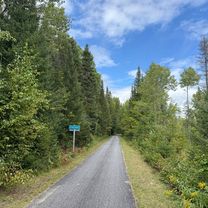
Beautiful route through the fields and countryside near the river. See you!
- -:--
- Duration
- 75.1 km
- Distance
- 195 m
- Ascent
- 195 m
- Descent
- ---
- Avg. speed
- ---
- Max. altitude

Route highlights
Points of interest along the route
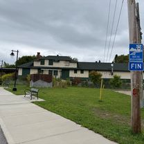
Point of interest after 18.4 km
Halte routière
Point of interest after 39.4 km
Dîner et toilettes près de la plage municipale
Continue with Bikemap
Use, edit, or download this cycling route
You would like to ride Mont-Laurier/Lac St-Paul/Mont-Laurier or customize it for your own trip? Here is what you can do with this Bikemap route:
Free features
- Save this route as favorite or in collections
- Copy & plan your own version of this route
- Sync your route with Garmin or Wahoo
Premium features
Free trial for 3 days, or one-time payment. More about Bikemap Premium.
- Navigate this route on iOS & Android
- Export a GPX / KML file of this route
- Create your custom printout (try it for free)
- Download this route for offline navigation
Discover more Premium features.
Get Bikemap PremiumFrom our community
Other popular routes starting in Mont-Laurier
 Mont-Laurier/Mont-St-Michel/Lac des Ecorces 90 k
- Distance
- 90.7 km
- Ascent
- 209 m
- Descent
- 209 m
- Location
- Mont-Laurier, Quebec, Canada
 Mont-Laurier/Lac St-Paul/Mont-Laurier
- Distance
- 75.1 km
- Ascent
- 195 m
- Descent
- 195 m
- Location
- Mont-Laurier, Quebec, Canada
 250906 Val Barrette to Nominingue
- Distance
- 40.5 km
- Ascent
- 138 m
- Descent
- 130 m
- Location
- Mont-Laurier, Quebec, Canada
 Day 23
- Distance
- 241.6 km
- Ascent
- 969 m
- Descent
- 1,003 m
- Location
- Mont-Laurier, Quebec, Canada
 250906 Mont Laurier to Val Barrette
- Distance
- 15 km
- Ascent
- 49 m
- Descent
- 30 m
- Location
- Mont-Laurier, Quebec, Canada
 Tour des Laurentides 2009 Day 3
- Distance
- 110.1 km
- Ascent
- 379 m
- Descent
- 389 m
- Location
- Mont-Laurier, Quebec, Canada
 Le Petit Train du Nord CLONED FROM ROUTE 234239
- Distance
- 218 km
- Ascent
- 391 m
- Descent
- 549 m
- Location
- Mont-Laurier, Quebec, Canada
 Le Petit Train du Nord CLONED FROM ROUTE 234239
- Distance
- 218 km
- Ascent
- 939 m
- Descent
- 1,098 m
- Location
- Mont-Laurier, Quebec, Canada
Open it in the app