

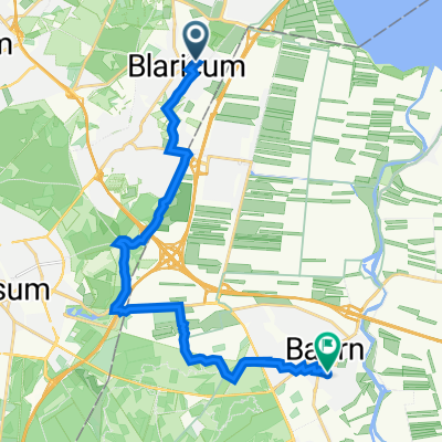
Hengeleer 14, Blaricum naar Hengeleer 14, Blaricum
A cycling route starting in Blaricum, North Holland, The Netherlands.
Overview
About this route
- 1 h 51 min
- Duration
- 40.7 km
- Distance
- 0 m
- Ascent
- 6 m
- Descent
- 22 km/h
- Avg. speed
- ---
- Max. altitude
Route quality
Waytypes & surfaces along the route
Waytypes
Cycleway
30.4 km
(75 %)
Quiet road
6.6 km
(16 %)
Surfaces
Paved
25.2 km
(62 %)
Unpaved
1.7 km
(4 %)
Asphalt
17.3 km
(43 %)
Paving stones
7.5 km
(18 %)
Continue with Bikemap
Use, edit, or download this cycling route
You would like to ride Hengeleer 14, Blaricum naar Hengeleer 14, Blaricum or customize it for your own trip? Here is what you can do with this Bikemap route:
Free features
- Save this route as favorite or in collections
- Copy & plan your own version of this route
- Sync your route with Garmin or Wahoo
Premium features
Free trial for 3 days, or one-time payment. More about Bikemap Premium.
- Navigate this route on iOS & Android
- Export a GPX / KML file of this route
- Create your custom printout (try it for free)
- Download this route for offline navigation
Discover more Premium features.
Get Bikemap PremiumFrom our community
Other popular routes starting in Blaricum
 SdC dag 1 Blaricum/Oosteind
- Distance
- 94.2 km
- Ascent
- 25 m
- Descent
- 26 m
- Location
- Blaricum, North Holland, The Netherlands
 Angerechtsweg 11, Blaricum naar Madurastraat 10, Baarn
- Distance
- 15.5 km
- Ascent
- 119 m
- Descent
- 116 m
- Location
- Blaricum, North Holland, The Netherlands
 Trage Tocht Blaricum Tafelberg Blaricumheide
- Distance
- 10.6 km
- Ascent
- 69 m
- Descent
- 70 m
- Location
- Blaricum, North Holland, The Netherlands
 Met Michel En wouter, Naarden
- Distance
- 27.9 km
- Ascent
- 102 m
- Descent
- 103 m
- Location
- Blaricum, North Holland, The Netherlands
 Witzand 7, Blaricum naar Museumlaan 1, Huizen
- Distance
- 3.1 km
- Ascent
- 18 m
- Descent
- 35 m
- Location
- Blaricum, North Holland, The Netherlands
 Meentweg 129, Eemnes naar Meentweg 131, Eemnes
- Distance
- 4.6 km
- Ascent
- 0 m
- Descent
- 0 m
- Location
- Blaricum, North Holland, The Netherlands
 2015 08 20 eemnes en Gooimeer
- Distance
- 51.8 km
- Ascent
- 22 m
- Descent
- 23 m
- Location
- Blaricum, North Holland, The Netherlands
 Blaricum
- Distance
- 13.2 km
- Ascent
- 48 m
- Descent
- 47 m
- Location
- Blaricum, North Holland, The Netherlands
Open it in the app