

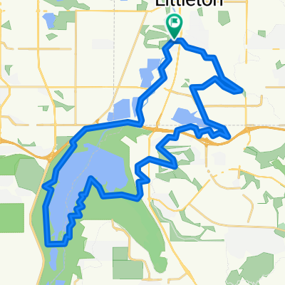
W Mineral Ave, Littleton to W Mineral Ave, Littleton
A cycling route starting in Columbine Valley, Colorado, United States.
Overview
About this route
- 1 h 47 min
- Duration
- 31.2 km
- Distance
- 204 m
- Ascent
- 204 m
- Descent
- 17.6 km/h
- Avg. speed
- ---
- Max. altitude

Route quality
Waytypes & surfaces along the route
Waytypes
Cycleway
29.5 km
(94 %)
Pedestrian area
1.2 km
(4 %)
Surfaces
Paved
7.4 km
(24 %)
Unpaved
22.5 km
(72 %)
Unpaved (undefined)
18.2 km
(58 %)
Paved (undefined)
5.9 km
(19 %)
Continue with Bikemap
Use, edit, or download this cycling route
You would like to ride W Mineral Ave, Littleton to W Mineral Ave, Littleton or customize it for your own trip? Here is what you can do with this Bikemap route:
Free features
- Save this route as favorite or in collections
- Copy & plan your own version of this route
- Sync your route with Garmin or Wahoo
Premium features
Free trial for 3 days, or one-time payment. More about Bikemap Premium.
- Navigate this route on iOS & Android
- Export a GPX / KML file of this route
- Create your custom printout (try it for free)
- Download this route for offline navigation
Discover more Premium features.
Get Bikemap PremiumFrom our community
Other popular routes starting in Columbine Valley
 Flying B Way 8537, Littleton to Flying B Way 8537, Highlands Ranch
- Distance
- 37.8 km
- Ascent
- 210 m
- Descent
- 189 m
- Location
- Columbine Valley, Colorado, United States
 W Mineral Ave, Littleton to W Mineral Ave, Littleton
- Distance
- 31.2 km
- Ascent
- 204 m
- Descent
- 204 m
- Location
- Columbine Valley, Colorado, United States
 Platte to Chatfield to Highline Canal Loop
- Distance
- 40 km
- Ascent
- 118 m
- Descent
- 116 m
- Location
- Columbine Valley, Colorado, United States
 Summer Wind Lane 2925, Littleton to Summer Wind Lane 2925, Littleton
- Distance
- 28 km
- Ascent
- 367 m
- Descent
- 385 m
- Location
- Columbine Valley, Colorado, United States
 Route to Flying B Way 8599, Highlands Ranch
- Distance
- 25.2 km
- Ascent
- 209 m
- Descent
- 172 m
- Location
- Columbine Valley, Colorado, United States
 3000 W Carson Dr, Littleton to 7357–7369 S Platte River Pkwy, Littleton
- Distance
- 53.6 km
- Ascent
- 187 m
- Descent
- 184 m
- Location
- Columbine Valley, Colorado, United States
 West Dry Creek Road 1587, Littleton to West Dry Creek Road 1601, Littleton
- Distance
- 23.5 km
- Ascent
- 141 m
- Descent
- 142 m
- Location
- Columbine Valley, Colorado, United States
 Highlands Ranch to Summer Wind Lane 2950, Littleton
- Distance
- 35.4 km
- Ascent
- 119 m
- Descent
- 97 m
- Location
- Columbine Valley, Colorado, United States
Open it in the app