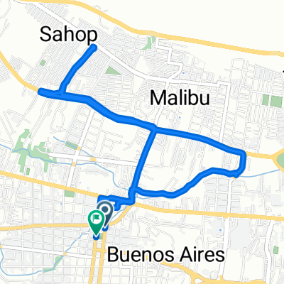
r150 ROAM
A cycling route starting in Tuxtla GutiƩrrez, Chiapas, Mexico.
Overview
About this route
<span style="font-family: Arial, Helvetica, sans-serif; font-size: 11px;">tuxtla gutierrez-canon del sumidero-tuxtla-teran-san fernando-chicoasen-osumacinta</span>
- -:--
- Duration
- 95.3 km
- Distance
- 1,607 m
- Ascent
- 1,752 m
- Descent
- ---
- Avg. speed
- ---
- Avg. speed
Continue with Bikemap
Use, edit, or download this cycling route
You would like to ride r150 ROAM or customize it for your own trip? Here is what you can do with this Bikemap route:
Free features
- Save this route as favorite or in collections
- Copy & plan your own version of this route
- Sync your route with Garmin or Wahoo
Premium features
Free trial for 3 days, or one-time payment. More about Bikemap Premium.
- Navigate this route on iOS & Android
- Export a GPX / KML file of this route
- Create your custom printout (try it for free)
- Download this route for offline navigation
Discover more Premium features.
Get Bikemap PremiumFrom our community
Other popular routes starting in Tuxtla GutiƩrrez
- Etapa Final de Vuelta Interanacional a Chiapas 2010
- Distance
- 12.8 km
- Ascent
- 106 m
- Descent
- 108 m
- Location
- Tuxtla GutiƩrrez, Chiapas, Mexico
- 4ta. Etapa de Vuelta Internacional a Chiapas 2010
- Distance
- 115.6 km
- Ascent
- 2,457 m
- Descent
- 1,210 m
- Location
- Tuxtla GutiƩrrez, Chiapas, Mexico
- Recovered Route
- Distance
- 11.7 km
- Ascent
- 229 m
- Descent
- 223 m
- Location
- Tuxtla GutiƩrrez, Chiapas, Mexico
- Cañón del Sumidero (ITT)
- Distance
- 23.2 km
- Ascent
- 882 m
- Descent
- 205 m
- Location
- Tuxtla GutiƩrrez, Chiapas, Mexico
- De SƔndalo Norte 405, Tuxtla GutiƩrrez a Montebello 374, Tuxtla GutiƩrrez
- Distance
- 15.8 km
- Ascent
- 108 m
- Descent
- 56 m
- Location
- Tuxtla GutiƩrrez, Chiapas, Mexico
- Cañón del Sumidero (ITT)
- Distance
- 32.2 km
- Ascent
- 974 m
- Descent
- 253 m
- Location
- Tuxtla GutiƩrrez, Chiapas, Mexico
- Chiapas Tuxtla Gutierrez- Cardenas
- Distance
- 204.3 km
- Ascent
- 1,054 m
- Descent
- 1,559 m
- Location
- Tuxtla GutiƩrrez, Chiapas, Mexico
- Recovered Route
- Distance
- 47.1 km
- Ascent
- 381 m
- Descent
- 371 m
- Location
- Tuxtla GutiƩrrez, Chiapas, Mexico
Open it in the app