

Radtour Großenkneten - Cloppenburg
A cycling route starting in Großenkneten, Lower Saxony, Germany.
Overview
About this route
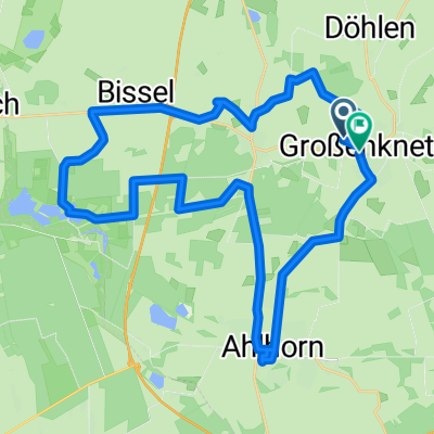
The ride goes from Großenkneten through the Sager Schweiz to the Ahlhorner Fischteiche nature reserve. From there, it continues along the Urwald Baumweg to Bethen and finally to Cloppenburg station.
- -:--
- Duration
- 28 km
- Distance
- 45 m
- Ascent
- 43 m
- Descent
- ---
- Avg. speed
- ---
- Max. altitude

Route quality
Waytypes & surfaces along the route
Waytypes
Quiet road
15.7 km
(56 %)
Track
9.2 km
(33 %)
Surfaces
Paved
12.9 km
(46 %)
Unpaved
9.5 km
(34 %)
Asphalt
12 km
(43 %)
Ground
4.8 km
(17 %)
Continue with Bikemap
Use, edit, or download this cycling route
You would like to ride Radtour Großenkneten - Cloppenburg or customize it for your own trip? Here is what you can do with this Bikemap route:
Free features
- Save this route as favorite or in collections
- Copy & plan your own version of this route
- Sync your route with Garmin or Wahoo
Premium features
Free trial for 3 days, or one-time payment. More about Bikemap Premium.
- Navigate this route on iOS & Android
- Export a GPX / KML file of this route
- Create your custom printout (try it for free)
- Download this route for offline navigation
Discover more Premium features.
Get Bikemap PremiumFrom our community
Other popular routes starting in Großenkneten
 4 Gemeinde Großenkneten Fahrradtour
- Distance
- 23.2 km
- Ascent
- 29 m
- Descent
- 35 m
- Location
- Großenkneten, Lower Saxony, Germany
 2 Gemeinde Großenkneten Fahrradtour
- Distance
- 17.3 km
- Ascent
- 39 m
- Descent
- 39 m
- Location
- Großenkneten, Lower Saxony, Germany
 Rundreise
- Distance
- 39.8 km
- Ascent
- 92 m
- Descent
- 93 m
- Location
- Großenkneten, Lower Saxony, Germany
 MTB Hunte Runde
- Distance
- 33.8 km
- Ascent
- 68 m
- Descent
- 68 m
- Location
- Großenkneten, Lower Saxony, Germany
 MTB Hunte
- Distance
- 36.8 km
- Ascent
- 47 m
- Descent
- 49 m
- Location
- Großenkneten, Lower Saxony, Germany
 Radtour Großenkneten - Cloppenburg
- Distance
- 28 km
- Ascent
- 45 m
- Descent
- 43 m
- Location
- Großenkneten, Lower Saxony, Germany
 Heidegrashüpfer Weg
- Distance
- 25 km
- Ascent
- 56 m
- Descent
- 58 m
- Location
- Großenkneten, Lower Saxony, Germany
 3 Gemeinde Großenkneten Fahrradtour
- Distance
- 23.3 km
- Ascent
- 41 m
- Descent
- 39 m
- Location
- Großenkneten, Lower Saxony, Germany
Open it in the app