

MTB zum Seebensee
A cycling route starting in Leutasch, Tyrol, Austria.
Overview
About this route
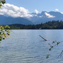
Mountain bike tour along the Leutascher Ache up to Seebensee.
Initially moderate, later with more incline - the return route (almost) only downhill.
- -:--
- Duration
- 34.4 km
- Distance
- 633 m
- Ascent
- 633 m
- Descent
- ---
- Avg. speed
- ---
- Max. altitude
Continue with Bikemap
Use, edit, or download this cycling route
You would like to ride MTB zum Seebensee or customize it for your own trip? Here is what you can do with this Bikemap route:
Free features
- Save this route as favorite or in collections
- Copy & plan your own version of this route
- Sync your route with Garmin or Wahoo
Premium features
Free trial for 3 days, or one-time payment. More about Bikemap Premium.
- Navigate this route on iOS & Android
- Export a GPX / KML file of this route
- Create your custom printout (try it for free)
- Download this route for offline navigation
Discover more Premium features.
Get Bikemap PremiumFrom our community
Other popular routes starting in Leutasch
 Leutasch - Seebensee
- Distance
- 20.5 km
- Ascent
- 608 m
- Descent
- 67 m
- Location
- Leutasch, Tyrol, Austria
 Entspannte Route
- Distance
- 41.9 km
- Ascent
- 567 m
- Descent
- 590 m
- Location
- Leutasch, Tyrol, Austria
 Kühtai
- Distance
- 117 km
- Ascent
- 2,486 m
- Descent
- 2,504 m
- Location
- Leutasch, Tyrol, Austria
 Ahrnspitzrunde Elmau Kranzbergrunde
- Distance
- 50.5 km
- Ascent
- 516 m
- Descent
- 519 m
- Location
- Leutasch, Tyrol, Austria
 Von Leutasch / Salzbach durch's Gaistal zum Seebensee
- Distance
- 29.2 km
- Ascent
- 675 m
- Descent
- 677 m
- Location
- Leutasch, Tyrol, Austria
 Leutasch - Vereineralm -Hinterris - Leutasch
- Distance
- 82.4 km
- Ascent
- 1,450 m
- Descent
- 1,450 m
- Location
- Leutasch, Tyrol, Austria
 Wettersteinrunde - Moser Tour Nr 37 CLONED FROM ROUTE 47855 CLONED FROM ROUTE 512664
- Distance
- 75.4 km
- Ascent
- 1,503 m
- Descent
- 1,503 m
- Location
- Leutasch, Tyrol, Austria
 MTB zum Seebensee
- Distance
- 34.4 km
- Ascent
- 633 m
- Descent
- 633 m
- Location
- Leutasch, Tyrol, Austria
Open it in the app