
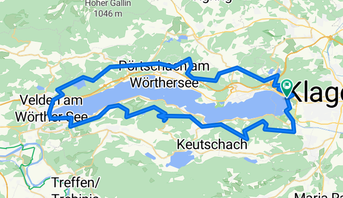
WörtherseeTrail - Mountainbiketour mit allen Schwierigkeitsgraden ausser extrem schwer
A cycling route starting in Klagenfurt, Carinthia, Austria.
Overview
About this route
...die Tour ist analog des Wörtherseerundwanderweges und ist mit blau-weiss-blauen Markierungen versehen. Im September jeden Jahres findet auf dieser Strecke der WörtherseeTrail Ultralauf statt. Die Streckenlänge ist 57 km und hat 1.700 Höhenmeter und hat alle Bodenbeschaffenheiten.
- -:--
- Duration
- 58.9 km
- Distance
- 1,279 m
- Ascent
- 1,277 m
- Descent
- ---
- Avg. speed
- ---
- Max. altitude

Continue with Bikemap
Use, edit, or download this cycling route
You would like to ride WörtherseeTrail - Mountainbiketour mit allen Schwierigkeitsgraden ausser extrem schwer or customize it for your own trip? Here is what you can do with this Bikemap route:
Free features
- Save this route as favorite or in collections
- Copy & plan your own version of this route
- Sync your route with Garmin or Wahoo
Premium features
Free trial for 3 days, or one-time payment. More about Bikemap Premium.
- Navigate this route on iOS & Android
- Export a GPX / KML file of this route
- Create your custom printout (try it for free)
- Download this route for offline navigation
Discover more Premium features.
Get Bikemap PremiumFrom our community
Other popular routes starting in Klagenfurt
 5150 Klagenfurt Bike
- Distance
- 41.6 km
- Ascent
- 327 m
- Descent
- 327 m
- Location
- Klagenfurt, Carinthia, Austria
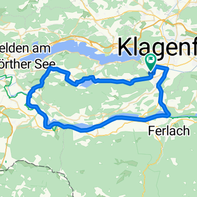 Seen-Runde und der Drau entlang
- Distance
- 54.8 km
- Ascent
- 336 m
- Descent
- 336 m
- Location
- Klagenfurt, Carinthia, Austria
 Klagenfurt – Drauradweg – Wörthersee-Nordufer - Klagenfurt
- Distance
- 71.8 km
- Ascent
- 621 m
- Descent
- 611 m
- Location
- Klagenfurt, Carinthia, Austria
 Entspannende Route in Klagenfurt am Wörthersee
- Distance
- 42 km
- Ascent
- 150 m
- Descent
- 158 m
- Location
- Klagenfurt, Carinthia, Austria
 Klagenfurt - Unterloibl - St. Margareten - Grafenstein
- Distance
- 66.9 km
- Ascent
- 376 m
- Descent
- 375 m
- Location
- Klagenfurt, Carinthia, Austria
 Schleppe - Wimitzbräu
- Distance
- 97.2 km
- Ascent
- 1,374 m
- Descent
- 1,376 m
- Location
- Klagenfurt, Carinthia, Austria
 WörtherseeTrail - Mountainbiketour mit allen Schwierigkeitsgraden ausser extrem schwer
- Distance
- 58.9 km
- Ascent
- 1,279 m
- Descent
- 1,277 m
- Location
- Klagenfurt, Carinthia, Austria
 Klagenfurt
- Distance
- 15.1 km
- Ascent
- 55 m
- Descent
- 97 m
- Location
- Klagenfurt, Carinthia, Austria
Open it in the app