

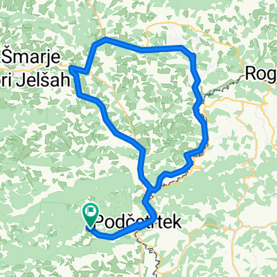
Overview
About this route
- -:--
- Duration
- 145.4 km
- Distance
- 1,081 m
- Ascent
- 559 m
- Descent
- ---
- Avg. speed
- 776 m
- Max. altitude

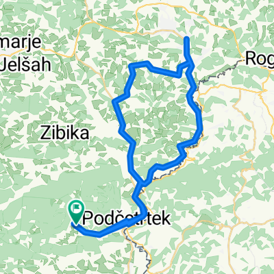
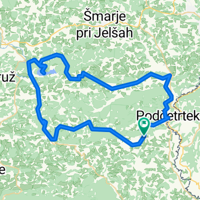
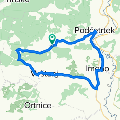
Part of
GP
3 stages
Route quality
Waytypes & surfaces along the route
Waytypes
Road
46.5 km
(32 %)
Quiet road
46.5 km
(32 %)
Surfaces
Paved
78.5 km
(54 %)
Unpaved
2.9 km
(2 %)
Asphalt
78.5 km
(54 %)
Unpaved (undefined)
1.5 km
(1 %)
Continue with Bikemap
Use, edit, or download this cycling route
You would like to ride GP 2. etapa or customize it for your own trip? Here is what you can do with this Bikemap route:
Free features
- Save this route as favorite or in collections
- Copy & plan your own version of this route
- Split it into stages to create a multi-day tour
- Sync your route with Garmin or Wahoo
Premium features
Free trial for 3 days, or one-time payment. More about Bikemap Premium.
- Navigate this route on iOS & Android
- Export a GPX / KML file of this route
- Create your custom printout (try it for free)
- Download this route for offline navigation
Discover more Premium features.
Get Bikemap PremiumFrom our community
Other popular routes starting in Podčetrtek
 Rogaška 1
- Distance
- 41.8 km
- Ascent
- 238 m
- Descent
- 239 m
- Location
- Podčetrtek, Občina Podčetrtek, Slovenia
 Slovenie, 2 oktober 2013, Podcetrtek-Novo Mesto
- Distance
- 112 km
- Ascent
- 852 m
- Descent
- 876 m
- Location
- Podčetrtek, Občina Podčetrtek, Slovenia
 Rogaška 3
- Distance
- 36.4 km
- Ascent
- 290 m
- Descent
- 291 m
- Location
- Podčetrtek, Občina Podčetrtek, Slovenia
 cmereška gorca - slivniško jezero - žeger - olimje
- Distance
- 55.4 km
- Ascent
- 915 m
- Descent
- 915 m
- Location
- Podčetrtek, Občina Podčetrtek, Slovenia
 Po Sloveniji 2020_2
- Distance
- 129.6 km
- Ascent
- 860 m
- Descent
- 862 m
- Location
- Podčetrtek, Občina Podčetrtek, Slovenia
 olimje
- Distance
- 60.5 km
- Ascent
- 2,767 m
- Descent
- 2,763 m
- Location
- Podčetrtek, Občina Podčetrtek, Slovenia
 2006 Akul SLO 4.dan (Podčetrtek - Laze pri Predgradu)
- Distance
- 172.2 km
- Ascent
- 1,536 m
- Descent
- 1,586 m
- Location
- Podčetrtek, Občina Podčetrtek, Slovenia
 Podčetrtek, Vištanj
- Distance
- 16.1 km
- Ascent
- 194 m
- Descent
- 194 m
- Location
- Podčetrtek, Občina Podčetrtek, Slovenia
Open it in the app