

Zur Ahr -Ahrradweg -Erftradweg -Urftradweg
A cycling route starting in Zulpich, North Rhine-Westphalia, Germany.
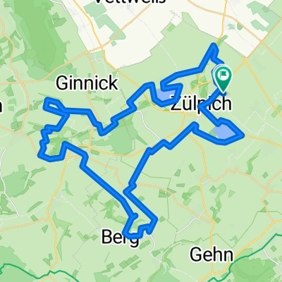
Overview
About this route
Von Ülpenich zur Ahr -AhrRadweg -ErftRadweg -UrftRadweg , zurück nach Hause
- -:--
- Duration
- 123.6 km
- Distance
- 777 m
- Ascent
- 777 m
- Descent
- ---
- Avg. speed
- ---
- Max. altitude

Route quality
Waytypes & surfaces along the route
Waytypes
Track
54.4 km
(44 %)
Quiet road
21 km
(17 %)
Surfaces
Paved
81.6 km
(66 %)
Unpaved
23.5 km
(19 %)
Asphalt
69.2 km
(56 %)
Paved (undefined)
12.4 km
(10 %)
Continue with Bikemap
Use, edit, or download this cycling route
You would like to ride Zur Ahr -Ahrradweg -Erftradweg -Urftradweg or customize it for your own trip? Here is what you can do with this Bikemap route:
Free features
- Save this route as favorite or in collections
- Copy & plan your own version of this route
- Split it into stages to create a multi-day tour
- Sync your route with Garmin or Wahoo
Premium features
Free trial for 3 days, or one-time payment. More about Bikemap Premium.
- Navigate this route on iOS & Android
- Export a GPX / KML file of this route
- Create your custom printout (try it for free)
- Download this route for offline navigation
Discover more Premium features.
Get Bikemap PremiumFrom our community
Other popular routes starting in Zulpich
 Zülpich, Glehn
- Distance
- 32.2 km
- Ascent
- 219 m
- Descent
- 219 m
- Location
- Zulpich, North Rhine-Westphalia, Germany
 eifelrunden ca. 110Km- 1300HM
- Distance
- 106.3 km
- Ascent
- 1,136 m
- Descent
- 1,135 m
- Location
- Zulpich, North Rhine-Westphalia, Germany
 Zülpich, Langendorf, Bürvenich, Wollersheim, Muldenau
- Distance
- 49.2 km
- Ascent
- 246 m
- Descent
- 246 m
- Location
- Zulpich, North Rhine-Westphalia, Germany
 Rheinradtour Juli 2022
- Distance
- 343.6 km
- Ascent
- 1,790 m
- Descent
- 1,790 m
- Location
- Zulpich, North Rhine-Westphalia, Germany
 Rhein Tour 2022
- Distance
- 333.8 km
- Ascent
- 2,451 m
- Descent
- 2,452 m
- Location
- Zulpich, North Rhine-Westphalia, Germany
 MTB in die schöne eifel mit Michelsberg- ca. 77Km und 1200HM
- Distance
- 76.2 km
- Ascent
- 726 m
- Descent
- 612 m
- Location
- Zulpich, North Rhine-Westphalia, Germany
 Spaziergang um Zülpich
- Distance
- 24.4 km
- Ascent
- 80 m
- Descent
- 80 m
- Location
- Zulpich, North Rhine-Westphalia, Germany
 Nur für Harte
- Distance
- 120.7 km
- Ascent
- 1,437 m
- Descent
- 1,437 m
- Location
- Zulpich, North Rhine-Westphalia, Germany
Open it in the app