

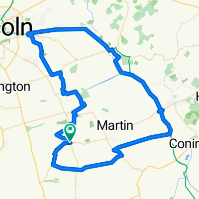
The Wolds 6 hill Route
A cycling route starting in Metheringham, England, United Kingdom.
Overview
About this route
Steady ride up in to The Wolds. Flat for the first 15 miles or so. Then Tetford Hill,Cawkwell Hii,Manor Hill,Rowgate Hill,Ruckland,Tetford 2nd Hill, then easy downhill to Horncastle
- -:--
- Duration
- 96.8 km
- Distance
- 548 m
- Ascent
- 550 m
- Descent
- ---
- Avg. speed
- ---
- Max. altitude
Route quality
Waytypes & surfaces along the route
Waytypes
Road
32.9 km
(34 %)
Quiet road
21.3 km
(22 %)
Surfaces
Paved
75.5 km
(78 %)
Unpaved
1.9 km
(2 %)
Asphalt
75.5 km
(78 %)
Gravel
1 km
(1 %)
Continue with Bikemap
Use, edit, or download this cycling route
You would like to ride The Wolds 6 hill Route or customize it for your own trip? Here is what you can do with this Bikemap route:
Free features
- Save this route as favorite or in collections
- Copy & plan your own version of this route
- Split it into stages to create a multi-day tour
- Sync your route with Garmin or Wahoo
Premium features
Free trial for 3 days, or one-time payment. More about Bikemap Premium.
- Navigate this route on iOS & Android
- Export a GPX / KML file of this route
- Create your custom printout (try it for free)
- Download this route for offline navigation
Discover more Premium features.
Get Bikemap PremiumFrom our community
Other popular routes starting in Metheringham
 Recovered Route
- Distance
- 4.5 km
- Ascent
- 25 m
- Descent
- 37 m
- Location
- Metheringham, England, United Kingdom
 The Wolds 6 hill Route
- Distance
- 96.8 km
- Ascent
- 548 m
- Descent
- 550 m
- Location
- Metheringham, England, United Kingdom
 Quick 9 miles
- Distance
- 16.1 km
- Ascent
- 64 m
- Descent
- 66 m
- Location
- Metheringham, England, United Kingdom
 Belchford Hill - Lowfield Lane
- Distance
- 50.5 km
- Ascent
- 343 m
- Descent
- 220 m
- Location
- Metheringham, England, United Kingdom
 Timberland loop, Lincolnshire
- Distance
- 49.3 km
- Ascent
- 118 m
- Descent
- 128 m
- Location
- Metheringham, England, United Kingdom
 Walk Dunston & Nocton
- Distance
- 7.6 km
- Ascent
- 28 m
- Descent
- 26 m
- Location
- Metheringham, England, United Kingdom
 Home to LVVS and return
- Distance
- 18.2 km
- Ascent
- 87 m
- Descent
- 95 m
- Location
- Metheringham, England, United Kingdom
 Water Railway
- Distance
- 69.9 km
- Ascent
- 113 m
- Descent
- 112 m
- Location
- Metheringham, England, United Kingdom
Open it in the app