

SZKLARSKA - LIBEREC/Frydlant/Świeradów - Szklarska
A cycling route starting in Szklarska Poręba, Lower Silesian Voivodeship, Poland.
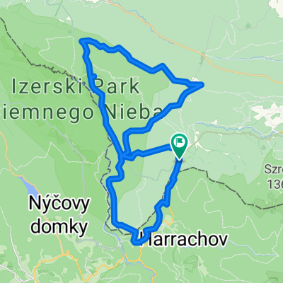
Overview
About this route
- -:--
- Duration
- 105.8 km
- Distance
- 1,493 m
- Ascent
- 1,462 m
- Descent
- ---
- Avg. speed
- ---
- Max. altitude

Route quality
Waytypes & surfaces along the route
Waytypes
Busy road
50 km
(47 %)
Road
43.4 km
(41 %)
Surfaces
Paved
95.8 km
(91 %)
Unpaved
0.7 km
(<1 %)
Asphalt
95.3 km
(90 %)
Ground
0.5 km
(<1 %)
Route highlights
Points of interest along the route
Point of interest after 51.4 km
Jested (skocznia)
Point of interest after 64.3 km
Frydlant
Continue with Bikemap
Use, edit, or download this cycling route
You would like to ride SZKLARSKA - LIBEREC/Frydlant/Świeradów - Szklarska or customize it for your own trip? Here is what you can do with this Bikemap route:
Free features
- Save this route as favorite or in collections
- Copy & plan your own version of this route
- Split it into stages to create a multi-day tour
- Sync your route with Garmin or Wahoo
Premium features
Free trial for 3 days, or one-time payment. More about Bikemap Premium.
- Navigate this route on iOS & Android
- Export a GPX / KML file of this route
- Create your custom printout (try it for free)
- Download this route for offline navigation
Discover more Premium features.
Get Bikemap PremiumFrom our community
Other popular routes starting in Szklarska Poręba
 SZKLARSKA - Harrachov - k/ŚWIERADÓW - Szklarska
- Distance
- 91 km
- Ascent
- 1,288 m
- Descent
- 1,318 m
- Location
- Szklarska Poręba, Lower Silesian Voivodeship, Poland
 Szklarska Poreba - No. 8
- Distance
- 34.7 km
- Ascent
- 606 m
- Descent
- 623 m
- Location
- Szklarska Poręba, Lower Silesian Voivodeship, Poland
 Izery - lite
- Distance
- 27.7 km
- Ascent
- 272 m
- Descent
- 272 m
- Location
- Szklarska Poręba, Lower Silesian Voivodeship, Poland
 Szklarska Poręba - Zwalisko - Przednia Kopa- Chatka Górzystów
- Distance
- 31.5 km
- Ascent
- 619 m
- Descent
- 618 m
- Location
- Szklarska Poręba, Lower Silesian Voivodeship, Poland
 Jakuszyce
- Distance
- 40.1 km
- Ascent
- 677 m
- Descent
- 677 m
- Location
- Szklarska Poręba, Lower Silesian Voivodeship, Poland
 Izery Jakuszyce
- Distance
- 24.6 km
- Ascent
- 440 m
- Descent
- 440 m
- Location
- Szklarska Poręba, Lower Silesian Voivodeship, Poland
 petla izerska
- Distance
- 42 km
- Ascent
- 493 m
- Descent
- 494 m
- Location
- Szklarska Poręba, Lower Silesian Voivodeship, Poland
 Fluggaenkoecchicebolsen
- Distance
- 279.5 km
- Ascent
- 428 m
- Descent
- 974 m
- Location
- Szklarska Poręba, Lower Silesian Voivodeship, Poland
Open it in the app