

Regentour am Main
A cycling route starting in Gesees, Bavaria, Germany.
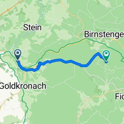
Overview
About this route
Wegen des starken Regen habe ich die Tour verkürzt.
- -:--
- Duration
- 13.6 km
- Distance
- 149 m
- Ascent
- 149 m
- Descent
- ---
- Avg. speed
- ---
- Max. altitude

Route quality
Waytypes & surfaces along the route
Waytypes
Quiet road
7.2 km
(53 %)
Track
5.7 km
(42 %)
Surfaces
Paved
3.7 km
(27 %)
Unpaved
4 km
(29 %)
Asphalt
3.7 km
(27 %)
Unpaved (undefined)
2 km
(15 %)
Route highlights
Points of interest along the route

Point of interest after 4.3 km

Point of interest after 7.2 km

Point of interest after 8.4 km

Point of interest after 9.9 km

Point of interest after 10.1 km
Continue with Bikemap
Use, edit, or download this cycling route
You would like to ride Regentour am Main or customize it for your own trip? Here is what you can do with this Bikemap route:
Free features
- Save this route as favorite or in collections
- Copy & plan your own version of this route
- Sync your route with Garmin or Wahoo
Premium features
Free trial for 3 days, or one-time payment. More about Bikemap Premium.
- Navigate this route on iOS & Android
- Export a GPX / KML file of this route
- Create your custom printout (try it for free)
- Download this route for offline navigation
Discover more Premium features.
Get Bikemap PremiumFrom our community
Other popular routes starting in Gesees
 Heimatrunde
- Distance
- 45.1 km
- Ascent
- 534 m
- Descent
- 541 m
- Location
- Gesees, Bavaria, Germany
 Fichtelgebirgsrunde
- Distance
- 122 km
- Ascent
- 1,439 m
- Descent
- 1,445 m
- Location
- Gesees, Bavaria, Germany
 2022 Ochsenkopf Runde ab Frankenhammer
- Distance
- 44.1 km
- Ascent
- 784 m
- Descent
- 784 m
- Location
- Gesees, Bavaria, Germany
 5. Tag ~ Bad Berneck - Weißenmainquelle - Fichtelsee
- Distance
- 19.8 km
- Ascent
- 563 m
- Descent
- 207 m
- Location
- Gesees, Bavaria, Germany
 Am Weißen Main
- Distance
- 28.4 km
- Ascent
- 281 m
- Descent
- 277 m
- Location
- Gesees, Bavaria, Germany
 From Bad Berneck im Fichtelgebirge to Warmensteinach
- Distance
- 12.3 km
- Ascent
- 662 m
- Descent
- 63 m
- Location
- Gesees, Bavaria, Germany
 Bad Berneck-Bayreuth-Theta und zurück
- Distance
- 37.8 km
- Ascent
- 420 m
- Descent
- 422 m
- Location
- Gesees, Bavaria, Germany
 Regentour am Main
- Distance
- 13.6 km
- Ascent
- 149 m
- Descent
- 149 m
- Location
- Gesees, Bavaria, Germany
Open it in the app