

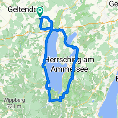
2007_Türkenfeld_Tutzing
A cycling route starting in Türkenfeld, Bavaria, Germany.
Overview
About this route
- -:--
- Duration
- 60.5 km
- Distance
- 320 m
- Ascent
- 305 m
- Descent
- ---
- Avg. speed
- ---
- Max. altitude

Route quality
Waytypes & surfaces along the route
Waytypes
Quiet road
37.8 km
(62 %)
Road
7.9 km
(13 %)
Surfaces
Paved
48.6 km
(80 %)
Unpaved
5 km
(8 %)
Asphalt
47 km
(78 %)
Unpaved (undefined)
3.5 km
(6 %)
Continue with Bikemap
Use, edit, or download this cycling route
You would like to ride 2007_Türkenfeld_Tutzing or customize it for your own trip? Here is what you can do with this Bikemap route:
Free features
- Save this route as favorite or in collections
- Copy & plan your own version of this route
- Sync your route with Garmin or Wahoo
Premium features
Free trial for 3 days, or one-time payment. More about Bikemap Premium.
- Navigate this route on iOS & Android
- Export a GPX / KML file of this route
- Create your custom printout (try it for free)
- Download this route for offline navigation
Discover more Premium features.
Get Bikemap PremiumFrom our community
Other popular routes starting in Türkenfeld
 St-Ottilien-Straße, Türkenfeld nach St-Ottilien-Straße, Türkenfeld
- Distance
- 64.4 km
- Ascent
- 588 m
- Descent
- 588 m
- Location
- Türkenfeld, Bavaria, Germany
 Recorded via Apple Watch - 30.05.21, 17:41
- Distance
- 15.6 km
- Ascent
- 78 m
- Descent
- 81 m
- Location
- Türkenfeld, Bavaria, Germany
 2007_Türkenfeld_Tutzing
- Distance
- 60.5 km
- Ascent
- 320 m
- Descent
- 305 m
- Location
- Türkenfeld, Bavaria, Germany
 Türkenfeld-Funkturm-Ampertal-300HM
- Distance
- 32.8 km
- Ascent
- 208 m
- Descent
- 208 m
- Location
- Türkenfeld, Bavaria, Germany
 50 - 00 - TF - Ottilien
- Distance
- 4.8 km
- Ascent
- 5 m
- Descent
- 12 m
- Location
- Türkenfeld, Bavaria, Germany
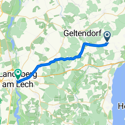
 Geltendorfer Straße 9, Türkenfeld nach Seefeld
- Distance
- 22.2 km
- Ascent
- 284 m
- Descent
- 323 m
- Location
- Türkenfeld, Bavaria, Germany
 Moorenweiser Straße nach Hubert-von-Herkomer-Straße
- Distance
- 20.5 km
- Ascent
- 111 m
- Descent
- 160 m
- Location
- Türkenfeld, Bavaria, Germany
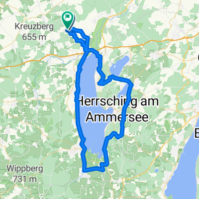 Türkenfeld-Ammersee-Andechs-509Hm
- Distance
- 64.9 km
- Ascent
- 326 m
- Descent
- 326 m
- Location
- Türkenfeld, Bavaria, Germany
Open it in the app