

Stage février
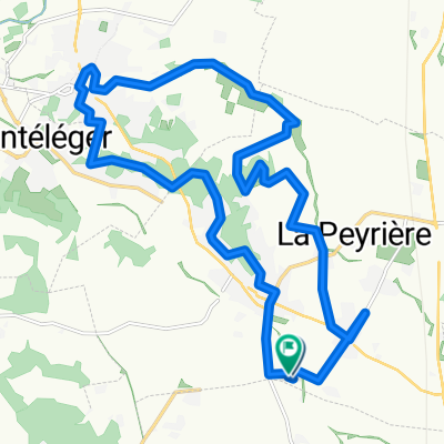
A cycling route starting in Montmeyran, Auvergne-Rhône-Alpes, France.
Overview
About this route
Des rushs, deux gpm et le sprint final de montmeyran.
- -:--
- Duration
- 67.1 km
- Distance
- 604 m
- Ascent
- 605 m
- Descent
- ---
- Avg. speed
- ---
- Max. altitude

Route quality
Waytypes & surfaces along the route
Waytypes
Busy road
31.2 km
(46 %)
Road
29.3 km
(44 %)
Surfaces
Paved
22.8 km
(34 %)
Unpaved
1 km
(2 %)
Asphalt
22.8 km
(34 %)
Gravel
0.9 km
(1 %)
Route highlights
Points of interest along the route
Point of interest after 19.4 km
Grand prix de la montagne
Point of interest after 33.6 km
RUSH
Point of interest after 38.4 km
GPM QUENTIN VAINQUEUR
Continue with Bikemap
Use, edit, or download this cycling route
You would like to ride Stage février or customize it for your own trip? Here is what you can do with this Bikemap route:
Free features
- Save this route as favorite or in collections
- Copy & plan your own version of this route
- Sync your route with Garmin or Wahoo
Premium features
Free trial for 3 days, or one-time payment. More about Bikemap Premium.
- Navigate this route on iOS & Android
- Export a GPX / KML file of this route
- Create your custom printout (try it for free)
- Download this route for offline navigation
Discover more Premium features.
Get Bikemap PremiumFrom our community
Other popular routes starting in Montmeyran
 VTT - Les Puits SUD
- Distance
- 28.1 km
- Ascent
- 567 m
- Descent
- 567 m
- Location
- Montmeyran, Auvergne-Rhône-Alpes, France
 La Rollande Nord
- Distance
- 32.8 km
- Ascent
- 100 m
- Descent
- 100 m
- Location
- Montmeyran, Auvergne-Rhône-Alpes, France
 VTT LES MASSEROLLES SUD + 16KM
- Distance
- 16.5 km
- Ascent
- 125 m
- Descent
- 126 m
- Location
- Montmeyran, Auvergne-Rhône-Alpes, France
 VTT - Les Puits Nord
- Distance
- 21.2 km
- Ascent
- 266 m
- Descent
- 267 m
- Location
- Montmeyran, Auvergne-Rhône-Alpes, France
 Stage février
- Distance
- 67.1 km
- Ascent
- 604 m
- Descent
- 605 m
- Location
- Montmeyran, Auvergne-Rhône-Alpes, France
 marn- ly
- Distance
- 1,015.4 km
- Ascent
- 1,763 m
- Descent
- 2,034 m
- Location
- Montmeyran, Auvergne-Rhône-Alpes, France
 VTT - La Rollande Circuit court
- Distance
- 13.3 km
- Ascent
- 94 m
- Descent
- 95 m
- Location
- Montmeyran, Auvergne-Rhône-Alpes, France
 La Rollande Nord-Ouest
- Distance
- 19.3 km
- Ascent
- 134 m
- Descent
- 135 m
- Location
- Montmeyran, Auvergne-Rhône-Alpes, France
Open it in the app