

training circular 1
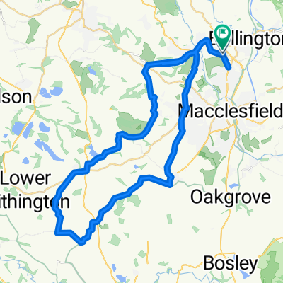
A cycling route starting in Prestbury, England, United Kingdom.
Overview
About this route
- -:--
- Duration
- 40.3 km
- Distance
- 234 m
- Ascent
- 240 m
- Descent
- ---
- Avg. speed
- ---
- Max. altitude
Route quality
Waytypes & surfaces along the route
Waytypes
Quiet road
18 km
(45 %)
Road
12.6 km
(31 %)
Surfaces
Paved
31.3 km
(78 %)
Asphalt
31.3 km
(78 %)
Undefined
9 km
(22 %)
Continue with Bikemap
Use, edit, or download this cycling route
You would like to ride training circular 1 or customize it for your own trip? Here is what you can do with this Bikemap route:
Free features
- Save this route as favorite or in collections
- Copy & plan your own version of this route
- Sync your route with Garmin or Wahoo
Premium features
Free trial for 3 days, or one-time payment. More about Bikemap Premium.
- Navigate this route on iOS & Android
- Export a GPX / KML file of this route
- Create your custom printout (try it for free)
- Download this route for offline navigation
Discover more Premium features.
Get Bikemap PremiumFrom our community
Other popular routes starting in Prestbury
 Egerton Arms
- Distance
- 11.3 km
- Ascent
- 85 m
- Descent
- 130 m
- Location
- Prestbury, England, United Kingdom
 Macclesfield east 32 km
- Distance
- 32.1 km
- Ascent
- 532 m
- Descent
- 533 m
- Location
- Prestbury, England, United Kingdom
 Devon Close 27 to Norfolk Walk 1
- Distance
- 5.8 km
- Ascent
- 3 m
- Descent
- 3 m
- Location
- Prestbury, England, United Kingdom
 training circular 2
- Distance
- 40.3 km
- Ascent
- 234 m
- Descent
- 240 m
- Location
- Prestbury, England, United Kingdom
 Suffolk Close 16 to Wood Lane South
- Distance
- 10.9 km
- Ascent
- 158 m
- Descent
- 162 m
- Location
- Prestbury, England, United Kingdom
 Stafford Close 10 to Stafford Close 10
- Distance
- 5.9 km
- Ascent
- 7 m
- Descent
- 0 m
- Location
- Prestbury, England, United Kingdom
 Willow Trees, Alderley Road, Macclesfield to 84 Knutsford Road, Alderley Edge
- Distance
- 12.2 km
- Ascent
- 116 m
- Descent
- 195 m
- Location
- Prestbury, England, United Kingdom
 53 Drummond Way, Macclesfield to Largo do Chafariz 3, Lousa
- Distance
- 5,497.4 km
- Ascent
- 17,153 m
- Descent
- 16,971 m
- Location
- Prestbury, England, United Kingdom
Open it in the app