

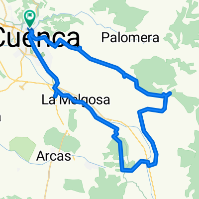
Ruta clásica: Cuenca - Las Majadas - Tragacete - Uña - Ciudad Encantada - Cuenca
A cycling route starting in Cuenca, Castille-La Mancha, Spain.
Overview
About this route
Ruta clásica: Cuenca - Las Majadas - Tragacete - Uña - Ciudad Encantada - Cuenca. Típica de Jueves Santo y semana de pasión.
- -:--
- Duration
- 144.3 km
- Distance
- 3,100 m
- Ascent
- 3,089 m
- Descent
- ---
- Avg. speed
- ---
- Max. altitude

Route quality
Waytypes & surfaces along the route
Waytypes
Road
30.3 km
(21 %)
Quiet road
20.2 km
(14 %)
Surfaces
Paved
21.6 km
(15 %)
Unpaved
2.9 km
(2 %)
Asphalt
17.3 km
(12 %)
Paved (undefined)
4.3 km
(3 %)
Continue with Bikemap
Use, edit, or download this cycling route
You would like to ride Ruta clásica: Cuenca - Las Majadas - Tragacete - Uña - Ciudad Encantada - Cuenca or customize it for your own trip? Here is what you can do with this Bikemap route:
Free features
- Save this route as favorite or in collections
- Copy & plan your own version of this route
- Split it into stages to create a multi-day tour
- Sync your route with Garmin or Wahoo
Premium features
Free trial for 3 days, or one-time payment. More about Bikemap Premium.
- Navigate this route on iOS & Android
- Export a GPX / KML file of this route
- Create your custom printout (try it for free)
- Download this route for offline navigation
Discover more Premium features.
Get Bikemap PremiumFrom our community
Other popular routes starting in Cuenca
 Alto de la Nava
- Distance
- 46.3 km
- Ascent
- 625 m
- Descent
- 624 m
- Location
- Cuenca, Castille-La Mancha, Spain
 Vallejo de la Cueva del Fraile
- Distance
- 41.9 km
- Ascent
- 446 m
- Descent
- 449 m
- Location
- Cuenca, Castille-La Mancha, Spain
 Las Zomas. La Mota
- Distance
- 42.6 km
- Ascent
- 517 m
- Descent
- 516 m
- Location
- Cuenca, Castille-La Mancha, Spain
 Casasola, Chantre, Cerro de San Cristobal
- Distance
- 40.7 km
- Ascent
- 476 m
- Descent
- 473 m
- Location
- Cuenca, Castille-La Mancha, Spain
 Hora y Media
- Distance
- 23.6 km
- Ascent
- 437 m
- Descent
- 435 m
- Location
- Cuenca, Castille-La Mancha, Spain
 Arroyo Bonilla
- Distance
- 25.9 km
- Ascent
- 604 m
- Descent
- 604 m
- Location
- Cuenca, Castille-La Mancha, Spain
 Lagunas de Fuentes
- Distance
- 40.5 km
- Ascent
- 318 m
- Descent
- 318 m
- Location
- Cuenca, Castille-La Mancha, Spain
 Mirador de el Ceño
- Distance
- 43.9 km
- Ascent
- 483 m
- Descent
- 483 m
- Location
- Cuenca, Castille-La Mancha, Spain
Open it in the app