Desafío - La Viñuela
A cycling route starting in Viñuela, Andalusia, Spain.
Overview
About this route
Magnificent route along the La Viñuela reservoir.
- -:--
- Duration
- 7.2 km
- Distance
- 115 m
- Ascent
- 121 m
- Descent
- ---
- Avg. speed
- ---
- Max. altitude
Route quality
Waytypes & surfaces along the route
Waytypes
Track
7 km
(97 %)
Path
0.2 km
(3 %)
Surfaces
Unpaved
6.9 km
(95 %)
Gravel
4 km
(55 %)
Unpaved (undefined)
2.7 km
(37 %)
Continue with Bikemap
Use, edit, or download this cycling route
You would like to ride Desafío - La Viñuela or customize it for your own trip? Here is what you can do with this Bikemap route:
Free features
- Save this route as favorite or in collections
- Copy & plan your own version of this route
- Sync your route with Garmin or Wahoo
Premium features
Free trial for 3 days, or one-time payment. More about Bikemap Premium.
- Navigate this route on iOS & Android
- Export a GPX / KML file of this route
- Create your custom printout (try it for free)
- Download this route for offline navigation
Discover more Premium features.
Get Bikemap PremiumFrom our community
Other popular routes starting in Viñuela
- day 3
- Distance
- 87 km
- Ascent
- 1,141 m
- Descent
- 1,118 m
- Location
- Viñuela, Andalusia, Spain
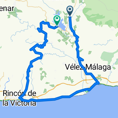
- Puente Don Manuel-El Alcazar-La Alcauca-Llanos de Zafarraya-antigua via del tren-Periana-Puente Don Manuel
- Distance
- 41 km
- Ascent
- 1,380 m
- Descent
- 1,295 m
- Location
- Viñuela, Andalusia, Spain
- MÁLAGA - Rincón de la Victoria - Moclinejo - Torre del Mar - Rincón
- Distance
- 52.5 km
- Ascent
- 967 m
- Descent
- 964 m
- Location
- Viñuela, Andalusia, Spain
- Viñuela - Alcaucin - Ventas de Zafarraya - Periana - Viñuela
- Distance
- 40.9 km
- Ascent
- 979 m
- Descent
- 976 m
- Location
- Viñuela, Andalusia, Spain
- Vinuela 40 km loop
- Distance
- 42.5 km
- Ascent
- 607 m
- Descent
- 586 m
- Location
- Viñuela, Andalusia, Spain
- Desafío - La Viñuela
- Distance
- 7.2 km
- Ascent
- 115 m
- Descent
- 121 m
- Location
- Viñuela, Andalusia, Spain
- Torre del Mar-Periana por via Tren-Vtas-Alcaucin
- Distance
- 63.9 km
- Ascent
- 884 m
- Descent
- 1,114 m
- Location
- Viñuela, Andalusia, Spain
- Xterra Viñuela 2014
- Distance
- 44.4 km
- Ascent
- 1,810 m
- Descent
- 1,812 m
- Location
- Viñuela, Andalusia, Spain
Open it in the app