

TROCHAS DEL ATLANTICO SUR
A cycling route starting in Piojó, Atlántico, Colombia.
Overview
About this route
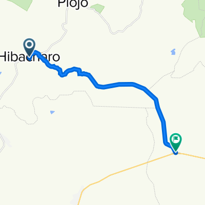
PIOJÓ-HIBACHARO-PALMAR DE CANDELARIA-ARROYO DE PIEDRA-ROTINET-REPELON-TABLAS-BARRIGON-LURUACO-HBACHARO-PIOJÓ
- -:--
- Duration
- 102.7 km
- Distance
- 1,188 m
- Ascent
- 1,190 m
- Descent
- ---
- Avg. speed
- ---
- Max. altitude

Route quality
Waytypes & surfaces along the route
Waytypes
Road
72.2 km
(70 %)
Quiet road
26.5 km
(26 %)
Surfaces
Paved
53.8 km
(52 %)
Unpaved
27.9 km
(27 %)
Asphalt
53.8 km
(52 %)
Unpaved (undefined)
14.4 km
(14 %)
Continue with Bikemap
Use, edit, or download this cycling route
You would like to ride TROCHAS DEL ATLANTICO SUR or customize it for your own trip? Here is what you can do with this Bikemap route:
Free features
- Save this route as favorite or in collections
- Copy & plan your own version of this route
- Split it into stages to create a multi-day tour
- Sync your route with Garmin or Wahoo
Premium features
Free trial for 3 days, or one-time payment. More about Bikemap Premium.
- Navigate this route on iOS & Android
- Export a GPX / KML file of this route
- Create your custom printout (try it for free)
- Download this route for offline navigation
Discover more Premium features.
Get Bikemap PremiumFrom our community
Other popular routes starting in Piojó
 MOLINERO - HIBÁCHARO
- Distance
- 13.8 km
- Ascent
- 183 m
- Descent
- 156 m
- Location
- Piojó, Atlántico, Colombia
 HIBÁCHARO - MOLINERO 15 KMS DE DIVERSIÓN
- Distance
- 14.7 km
- Ascent
- 133 m
- Descent
- 159 m
- Location
- Piojó, Atlántico, Colombia
 Ruta desde Calle 16, Luruaco
- Distance
- 0.5 km
- Ascent
- 3 m
- Descent
- 4 m
- Location
- Piojó, Atlántico, Colombia
 De Colombia a Santa Marta
- Distance
- 168.6 km
- Ascent
- 829 m
- Descent
- 3,785 m
- Location
- Piojó, Atlántico, Colombia
 TROCHAS DEL ATLANTICO SUR
- Distance
- 102.7 km
- Ascent
- 1,188 m
- Descent
- 1,190 m
- Location
- Piojó, Atlántico, Colombia
 EL CERRITO - MOLINERO 28 KMS
- Distance
- 28.1 km
- Ascent
- 186 m
- Descent
- 170 m
- Location
- Piojó, Atlántico, Colombia
 MOLINERO - HIBÁCHARO
- Distance
- 13.9 km
- Ascent
- 148 m
- Descent
- 110 m
- Location
- Piojó, Atlántico, Colombia
Open it in the app