

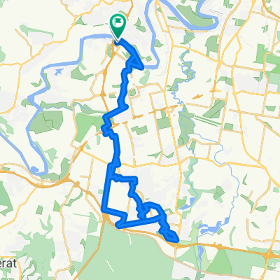
Western Suburbs River loop MTB
A cycling route starting in Seventeen Mile Rocks, Queensland, Australia.
Overview
About this route
Some single track, mostly paved
- -:--
- Duration
- 23.7 km
- Distance
- 158 m
- Ascent
- 156 m
- Descent
- ---
- Avg. speed
- ---
- Max. altitude

Route quality
Waytypes & surfaces along the route
Waytypes
Cycleway
9.7 km
(41 %)
Road
4 km
(17 %)
Surfaces
Paved
16.4 km
(69 %)
Unpaved
2.3 km
(10 %)
Concrete
7.9 km
(33 %)
Paved (undefined)
5 km
(21 %)
Continue with Bikemap
Use, edit, or download this cycling route
You would like to ride Western Suburbs River loop MTB or customize it for your own trip? Here is what you can do with this Bikemap route:
Free features
- Save this route as favorite or in collections
- Copy & plan your own version of this route
- Sync your route with Garmin or Wahoo
Premium features
Free trial for 3 days, or one-time payment. More about Bikemap Premium.
- Navigate this route on iOS & Android
- Export a GPX / KML file of this route
- Create your custom printout (try it for free)
- Download this route for offline navigation
Discover more Premium features.
Get Bikemap PremiumFrom our community
Other popular routes starting in Seventeen Mile Rocks
 From Darra to West End
- Distance
- 21 km
- Ascent
- 212 m
- Descent
- 223 m
- Location
- Seventeen Mile Rocks, Queensland, Australia
 FTP - Gap Creek - Samford- Eatons Crossing - Park Rd - FTP
- Distance
- 72.5 km
- Ascent
- 541 m
- Descent
- 541 m
- Location
- Seventeen Mile Rocks, Queensland, Australia
 17 Mile Rocks to Forest Lake loop v3
- Distance
- 46.3 km
- Ascent
- 221 m
- Descent
- 220 m
- Location
- Seventeen Mile Rocks, Queensland, Australia
 Western Suburbs River loop MTB
- Distance
- 23.7 km
- Ascent
- 158 m
- Descent
- 156 m
- Location
- Seventeen Mile Rocks, Queensland, Australia
 Another River Loop
- Distance
- 31.4 km
- Ascent
- 220 m
- Descent
- 220 m
- Location
- Seventeen Mile Rocks, Queensland, Australia
 Forest lake v2
- Distance
- 43.7 km
- Ascent
- 203 m
- Descent
- 203 m
- Location
- Seventeen Mile Rocks, Queensland, Australia
 upper brookfield Jindalee loop
- Distance
- 47.7 km
- Ascent
- 412 m
- Descent
- 415 m
- Location
- Seventeen Mile Rocks, Queensland, Australia
 Brisbane River Run (Medium)
- Distance
- 52.4 km
- Ascent
- 264 m
- Descent
- 265 m
- Location
- Seventeen Mile Rocks, Queensland, Australia
Open it in the app