

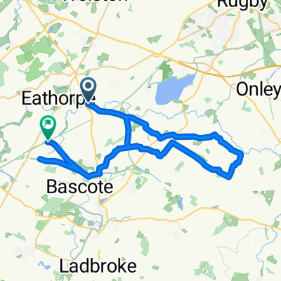
Manor Farm Cottage, Main St, Rugby to Ivy House, Main St, Rugby
A cycling route starting in Long Itchington, England, United Kingdom.
Overview
About this route
- 1 h 26 min
- Duration
- 23.5 km
- Distance
- 149 m
- Ascent
- 149 m
- Descent
- 16.4 km/h
- Avg. speed
- ---
- Max. altitude
Route quality
Waytypes & surfaces along the route
Waytypes
Road
12.9 km
(55 %)
Quiet road
9.4 km
(40 %)
Undefined
1.2 km
(5 %)
Surfaces
Paved
16.2 km
(69 %)
Asphalt
16.2 km
(69 %)
Undefined
7.3 km
(31 %)
Continue with Bikemap
Use, edit, or download this cycling route
You would like to ride Manor Farm Cottage, Main St, Rugby to Ivy House, Main St, Rugby or customize it for your own trip? Here is what you can do with this Bikemap route:
Free features
- Save this route as favorite or in collections
- Copy & plan your own version of this route
- Sync your route with Garmin or Wahoo
Premium features
Free trial for 3 days, or one-time payment. More about Bikemap Premium.
- Navigate this route on iOS & Android
- Export a GPX / KML file of this route
- Create your custom printout (try it for free)
- Download this route for offline navigation
Discover more Premium features.
Get Bikemap PremiumFrom our community
Other popular routes starting in Long Itchington
 40k on approved roads :)
- Distance
- 36.5 km
- Ascent
- 191 m
- Descent
- 161 m
- Location
- Long Itchington, England, United Kingdom
 globes birthday bike ride
- Distance
- 56.5 km
- Ascent
- 239 m
- Descent
- 268 m
- Location
- Long Itchington, England, United Kingdom
 Leamington Spa to Limestone Hall Lane
- Distance
- 25 km
- Ascent
- 201 m
- Descent
- 212 m
- Location
- Long Itchington, England, United Kingdom
 Marton to Leamington and back
- Distance
- 29 km
- Ascent
- 249 m
- Descent
- 250 m
- Location
- Long Itchington, England, United Kingdom
 Lambert route
- Distance
- 40 km
- Ascent
- 218 m
- Descent
- 196 m
- Location
- Long Itchington, England, United Kingdom
 Steady ride
- Distance
- 22.3 km
- Ascent
- 150 m
- Descent
- 134 m
- Location
- Long Itchington, England, United Kingdom
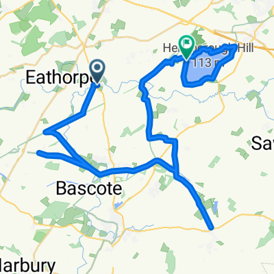
 Around Draycote Water
- Distance
- 14.7 km
- Ascent
- 85 m
- Descent
- 83 m
- Location
- Long Itchington, England, United Kingdom
 Route 4 (Stonebridge Lane)
- Distance
- 10.1 km
- Ascent
- 48 m
- Descent
- 64 m
- Location
- Long Itchington, England, United Kingdom
Open it in the app