
Stone Ridge - Manassas Battlefield Loop
A cycling route starting in South Riding, Virginia, United States.
Overview
About this route
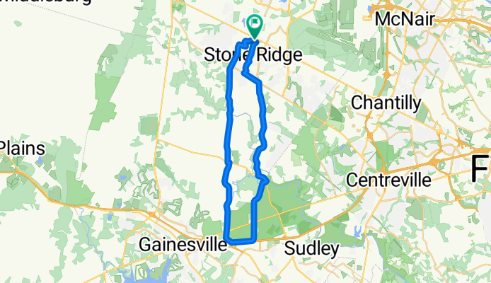
Start from Stone Springs Harris Teeter Parking Lot and Break Point at Manassas Battlefield Picninc Area.
- -:--
- Duration
- 40.2 km
- Distance
- 209 m
- Ascent
- 209 m
- Descent
- ---
- Avg. speed
- ---
- Max. altitude
Route quality
Waytypes & surfaces along the route
Waytypes
Busy road
23.3 km
(58 %)
Quiet road
7.2 km
(18 %)
Surfaces
Paved
28.9 km
(72 %)
Unpaved
1.8 km
(4 %)
Asphalt
28.8 km
(72 %)
Gravel
1.8 km
(4 %)
Continue with Bikemap
Use, edit, or download this cycling route
You would like to ride Stone Ridge - Manassas Battlefield Loop or customize it for your own trip? Here is what you can do with this Bikemap route:
Free features
- Save this route as favorite or in collections
- Copy & plan your own version of this route
- Sync your route with Garmin or Wahoo
Premium features
Free trial for 3 days, or one-time payment. More about Bikemap Premium.
- Navigate this route on iOS & Android
- Export a GPX / KML file of this route
- Create your custom printout (try it for free)
- Download this route for offline navigation
Discover more Premium features.
Get Bikemap PremiumFrom our community
Other popular routes starting in South Riding
 GumSpring route
- Distance
- 37.7 km
- Ascent
- 277 m
- Descent
- 277 m
- Location
- South Riding, Virginia, United States
 25546 Brantingham Cir, Aldie to 25546 Brantingham Cir, Aldie
- Distance
- 10.5 km
- Ascent
- 109 m
- Descent
- 108 m
- Location
- South Riding, Virginia, United States
 Curiosity Square 25333, Aldie to Patriot Terrace 25408, Aldie
- Distance
- 6.4 km
- Ascent
- 0 m
- Descent
- 3 m
- Location
- South Riding, Virginia, United States
 43536 Heritage Gap Terr, Chantilly to 43539 Heritage Gap Terr, Chantilly
- Distance
- 13.8 km
- Ascent
- 479 m
- Descent
- 479 m
- Location
- South Riding, Virginia, United States
 Eloquence Terrace 41826, Aldie to Patriot Terrace 25382, Aldie
- Distance
- 7.8 km
- Ascent
- 53 m
- Descent
- 60 m
- Location
- South Riding, Virginia, United States
 25565 Emerson Oaks Dr, Aldie to 25546 Brantingham Cir, Aldie
- Distance
- 21.9 km
- Ascent
- 114 m
- Descent
- 114 m
- Location
- South Riding, Virginia, United States
 Stone Ridge - Manassas Battlefield Loop
- Distance
- 40.2 km
- Ascent
- 209 m
- Descent
- 209 m
- Location
- South Riding, Virginia, United States
 Moderate route in
- Distance
- 5.4 km
- Ascent
- 0 m
- Descent
- 4 m
- Location
- South Riding, Virginia, United States
Open it in the app